Category:Maps of Thuringian Forest
Jump to navigation
Jump to search
Media in category "Maps of Thuringian Forest"
The following 17 files are in this category, out of 17 total.
-
 APicWolkenbildung.png 1,035 × 644; 16 KB
-
 Atlas Cosmographicae (Mercator) 203 (Thüringer Wald).jpg 1,118 × 786; 525 KB
-
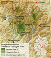 Biosphärenreservat Vessertal-Thüringer Wald.png 531 × 600; 334 KB
-
-
 Der Thüringer Wald.jpg 5,922 × 5,295; 12.5 MB
-
 Liebensteinbahn.png 473 × 344; 403 KB
-
 Location Thüringer Wald.PNG 506 × 439; 40 KB
-
 Map Wilhelmsthal.png 1,260 × 1,549; 5.03 MB
-
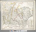
 Naturraumkarte Obermainisches Huegelland.png 1,401 × 913; 1.49 MB
-
 Naturraumkarte Thueringer Wald.png 934 × 898; 1.21 MB
-
 Naturraumkarte Thueringisch-Fraenkisches Mittelgebirge mit Vogtland.png 2,111 × 1,693; 4.63 MB
-
 The Rhine and northern Germany- handbook for travellers (1870) (14765786142).jpg 2,032 × 1,460; 1.35 MB
-
 Thuringian Forest Geology.png 3,226 × 2,501; 2.19 MB
-
 Thüringer Wald - Deutsche Mittelgebirge, Serie A-de.png 2,200 × 1,850; 5.3 MB
-
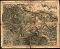
 Thüringer wald map 1860.jpg 1,512 × 1,025; 404 KB
-
 Thüringer Wald.png 188 × 235; 7 KB
-
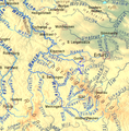 Werra-Zuflüsse topo.png 1,280 × 1,305; 2.72 MB

_203_(Th%C3%BCringer_Wald).jpg)


_(14765786142).jpg)


