Category:Maps of Thessaloniki
Jump to navigation
Jump to search
Wikimedia category | |||||
| Upload media | |||||
| Instance of | |||||
|---|---|---|---|---|---|
| Category combines topics | |||||
| Thessaloniki | |||||
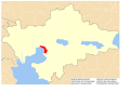
city in Macedonia, Greece    | |||||
| Instance of | |||||
| Named after |
| ||||
| Patron saint | |||||
| Location | |||||
| Located in or next to body of water | |||||
| Official language | |||||
| Head of government |
| ||||
| Inception |
| ||||
| Significant event |
| ||||
| Population |
| ||||
| Area |
| ||||
| Elevation above sea level |
| ||||
| Different from | |||||
| official website | |||||
 | |||||
Subcategories
This category has the following 3 subcategories, out of 3 total.
O
- Old maps of Thessaloniki (14 F)
P
Media in category "Maps of Thessaloniki"
The following 91 files are in this category, out of 91 total.
-
 Thoman Mawson Thessaloniki proposal, 1918.png 6,064 × 3,061; 14.05 MB
-
 2010 Dimi Thessalonikis numbered (urban, metropolitan).png 250 × 176; 27 KB
-
 2010 Dimos Thessalonikis.svg 2,278 × 1,608; 121 KB
-
 2011 Dimos Thessalonikis.png 1,200 × 883; 190 KB
-
 Admiralty Chart No 2070 Kolpos Thessalonikis, Published 1961.jpg 16,193 × 11,094; 40.45 MB
-
 Aristotelous Square Map.svg 1,156 × 1,028; 929 KB
-
 Dim-agioupavlou.png 465 × 500; 65 KB
-
 Dim-ampelokipon.png 465 × 500; 68 KB
-
 Dim-eyosmou.png 465 × 500; 65 KB
-
 Dim.kalamarias.png 465 × 500; 65 KB
-
 Dim.neapolis.png 465 × 500; 73 KB
-
 Dim.polihnis.png 465 × 500; 68 KB
-
 Dim.stavroupolis.png 465 × 500; 73 KB
-
 Dim.thessalonikis.png 465 × 500; 65 KB
-
 Dim.triandrias.png 465 × 500; 65 KB
-

-

-

-

-

-

-

-

-

-

-

-

-

-

-

-

-

-

-
-

-

-

-

-

-

-
 Dimos Thessalonikis - Central Macedonia.svg 707 × 627; 79 KB
-
-

-

-

-
 Iasonidou street.png 822 × 799; 470 KB
-
 Indice - es.png 826 × 843; 181 KB
-
 K11 Interchange.png 1,044 × 809; 147 KB
-
 Lagkada street, Thessaloniki, Greece map.png 577 × 609; 200 KB
-
 Map 18.pdf 7,020 × 4,966; 8.2 MB
-
 Map of Thessaloniki - Central.png 2,252 × 1,549; 2.31 MB
-
 Map of Thessaloniki - Metro overlay.svg 8,445 × 9,323; 26 KB
-
 Map of Thessaloniki - South East.png 2,252 × 1,549; 2.33 MB
-
 Map of Thessaloniki - South.png 2,252 × 1,632; 1.72 MB
-
 Map of Thessaloniki - Whole.png 6,756 × 7,458; 21.37 MB
-
 Map of Thessaloniki 2.png 2,017 × 1,869; 2.56 MB
-
 Map of Thessaloniki.png 2,133 × 1,863; 2.46 MB
-
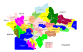
 Municipalities of Thessaloniki.svg 11,204 × 7,512; 188 KB
-
 Pol.thessaloniki.png 465 × 500; 66 KB
-
 Ring road thessaloniki map.jpg 755 × 600; 185 KB
-
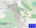
 THES-Heptapyrgion location.png 246 × 334; 41 KB
-
 Thessaloniki and suburbs Road Map - 20080801.svg 1,498 × 1,207; 1.4 MB
-
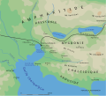
 Thessaloniki area in Antiquity.png 1,062 × 963; 164 KB
-
 Thessaloniki area.svg 711 × 644; 107 KB
-
 Thessaloniki historic city centre (with metro).svg 1,456 × 1,890; 2.49 MB
-
 Thessaloniki historic city centre.svg 1,456 × 1,890; 2.42 MB
-
 Thessaloniki historical center el.svg 741 × 945; 272 KB
-
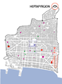
 Thessaloniki historical center el2.png 2,000 × 2,611; 1.34 MB
-
 Thessaloniki historical center es.svg 723 × 944; 402 KB
-
 Thessaloniki historical center mk.svg 723 × 944; 629 KB
-
 Thessaloniki historical center uk.svg 723 × 944; 204 KB
-
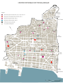 Thessaloniki historical center.svg 723 × 944; 204 KB
-
 Thessaloniki Metropolitan Area (1990).png 2,000 × 1,412; 402 KB
-

-

-
 Thessaloniki Metropolitan Region.svg 1,014 × 699; 595 KB
-
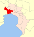
 Thessaloniki Prefecture, Greece - political map - dimi level - DE labels.svg 1,402 × 993; 727 KB
-
 Thessaloniki Prefecture, Greece - political map - low detail - numbered.svg 1,052 × 744; 368 KB
-
 Thessaloniki Prefecture, Greece - political map - simplified - DE labels.svg 1,633 × 1,013; 386 KB
-
 Thessaloniki Road Map.svg 1,155 × 1,025; 5.06 MB
-
 Thessaloniki urban and metropolitan areas map 2.svg 550 × 504; 301 KB
-
 Thessaloniki urban and metropolitan areas map.svg 1,024 × 759; 189 KB
-
 Thessaloniki Urban Area, Greece - political map - blank.png 350 × 242; 24 KB
-
 Thessaloniki urban area.png 2,000 × 1,412; 401 KB
-
 Thessaloniki urban growth 1.svg 363 × 608; 81 KB
-
 Thessaloniki urban growth 2.svg 364 × 606; 198 KB
-
 Thessaloniki.png 200 × 204; 34 KB
-
 Índice - copia.png 826 × 843; 146 KB
-
 Δήμος Μενεμένης.png 465 × 500; 65 KB
-
 Μητροπολιτική ενότητα Θεσσαλονίκης, Μακεδονία, Ελλάδα.png 2,560 × 1,898; 534 KB
-
 Солунски округ.svg 1,402 × 993; 1.46 MB

.png)


.svg)


.png)


,_Greece_-_political_map_-_blank.png)
,_Greece_-_political_map_-_blank.png)