Category:Maps of Taiwanese aborigines
Jump to navigation
Jump to search
Media in category "Maps of Taiwanese aborigines"
The following 23 files are in this category, out of 23 total.
-
 17 世紀以降大武壠族各社群遷徙及分佈圖.png 1,079 × 756; 996 KB
-

-
 Amis in Taiwan.png 1,785 × 2,193; 70 KB
-
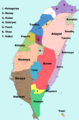
 Formosan Distribution 01.png 1,200 × 1,600; 1.21 MB
-
 Formosan Distribution en.png 1,500 × 2,278; 1.29 MB
-
 Formosan Distribution.png 1,200 × 1,600; 1.23 MB
-
 Formosan languages de.svg 775 × 1,043; 232 KB
-
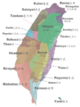
 General distribution of indigenous people in Taiwan.svg 602 × 980; 151 KB
-
 Geographic Distribution of Nine Indigenous Tribes of Taiwan.png 2,020 × 2,841; 3.61 MB
-
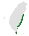
 Paiwan in Taiwan.png 368 × 599; 26 KB
-
 Saaroa map.png 639 × 624; 96 KB
-
 Taivoan Expansion in Southern Taiwan before 20th Century.png 1,080 × 789; 1.78 MB
-
 Taiwan aborigine.jpg 356 × 498; 24 KB
-
 Taiwan Formosan.svg 619 × 842; 938 KB
-
 Taiwan indigenous people distribution 1936.jpg 2,067 × 3,015; 4.26 MB
-
 Taïwan ethnies.JPG 1,376 × 2,030; 304 KB
-
 〈高砂族分布圖〉(複製品)恆春郡部分.jpg 3,064 × 4,592; 6.82 MB
-
 〈高砂族分布圖〉(複製品)新高郡部分.jpg 3,424 × 3,424; 5.83 MB
-
 〈高砂族分布圖〉(複製品)潮州郡南部部分.jpg 3,424 × 3,424; 5.66 MB
-
 原住民族地區16族分布圖.jpg 1,081 × 1,531; 368 KB
-
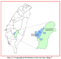
 清初平埔族群分佈圖.jpg 672 × 960; 146 KB
-
 臺灣蕃地圖.jpg 2,214 × 3,053; 2.55 MB
-
 臺灣蕃族分布圖.jpg 3,712 × 5,404; 1.46 MB


