Category:Maps of Strasbourg city walls
Jump to navigation
Jump to search
Media in category "Maps of Strasbourg city walls"
The following 22 files are in this category, out of 22 total.
-
 Plan de la citadelle de Strasbourg 1693.svg 2,728 × 2,318; 7.6 MB
-
 Plan de Strasbourg 1693.jpg 12,499 × 5,027; 5.62 MB
-
 Plan de Strasbourg 1693.svg 12,743 × 7,200; 7.59 MB
-
 Strasbourg 1706.jpg 1,023 × 404; 182 KB
-
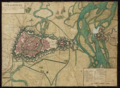
 Plan de Strasbourg 1720.jpg 10,236 × 7,464; 10.99 MB
-
 Plan de Strasbourg 1740.jpg 11,169 × 7,023; 11.71 MB
-
 Plan de Strasbourg 1750.jpg 9,607 × 6,570; 8.33 MB
-
 Carte ville et citadelle de Strasbourg (avant 1800).jpg 11,014 × 7,534; 23.14 MB
-
 Chorographia Argentorati Alsati metropolis.jpg 6,816 × 5,776; 11.02 MB
-
 Eglise Sainte-Aurélie de Strasbourg-Merian-1643.jpg 1,384 × 1,078; 362 KB
-
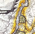 Festung Kehl 1788.jpg 848 × 832; 541 KB
-
 Fotothek df tg 0002912 Architektur ^ Festungsbau ^ Zitadelle.jpg 658 × 820; 279 KB
-
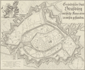
 Plan citadelle de Strasbourg (avant 1800).jpg 1,595 × 1,332; 725 KB
-
 Plan Strasbourg 1720.png 5,859 × 4,281; 46.08 MB
-
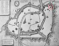
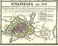 Spruner-Menke Handatlas 1880 Karte 45 Nebenkarte 5.jpg 1,176 × 938; 117 KB
-
 Strasbourg 1681.png 691 × 393; 366 KB
-
 Strasbourg en 1680.png 2,977 × 2,474; 13.95 MB
-
 Strasbourg PlanMérian 1643.jpg 2,467 × 1,861; 1.69 MB
-
 Strasbourg1785.jpg 1,285 × 1,024; 317 KB
-
 Strasbourgh 1680.jpg 642 × 542; 99 KB
-
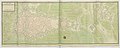
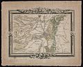
 Strasburg and the fortress of Kehl, 1734.jpg 1,276 × 1,071; 861 KB
-
 Straßburg II.jpg 2,071 × 3,185; 1.35 MB


.jpg)


.jpg)


