Category:Maps of Steenderen
Jump to navigation
Jump to search
Wikimedia category | |||||
| Upload media | |||||
| Instance of | |||||
|---|---|---|---|---|---|
| Category combines topics | |||||
| Steenderen | |||||
village in Bronckhorst, Netherlands     | |||||
| Spoken text audio | |||||
| Instance of | |||||
| Location |
| ||||
| Population |
| ||||
 | |||||
Media in category "Maps of Steenderen"
The following 2 files are in this category, out of 2 total.
-
 LocatieSteenderen.png 280 × 140; 9 KB
-
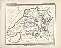 Steenderen, Gemeenteatlas van Nederland.jpg 2,124 × 1,662; 4.57 MB

