Category:Maps of Southampton
Jump to navigation
Jump to search
Wikimedia category | |||||
| Upload media | |||||
| Instance of | |||||
|---|---|---|---|---|---|
| Category combines topics | |||||
| Southampton | |||||
city and major port in Hampshire, South-East England, United Kingdom   | |||||
| Instance of | |||||
| Location | City of Southampton, Hampshire, South East England, England | ||||
| Located in or next to body of water | |||||
| Official language | |||||
| Population |
| ||||
| Area |
| ||||
| Different from | |||||
| Said to be the same as | Hamwic | ||||
| official website | |||||
 | |||||
Maps featuring Southampton, UK
Subcategories
This category has the following 2 subcategories, out of 2 total.
E
- Election maps of Southampton (18 F)
Media in category "Maps of Southampton"
The following 37 files are in this category, out of 37 total.
-
 Admiralty Chart No 1905 Southampton Water, Published 1963.jpg 16,454 × 11,176; 67.76 MB
-
 Admiralty Chart No 2041 Port of Southampton, Published 1965.jpg 16,201 × 11,129; 66.83 MB
-
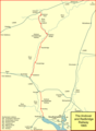 Andover and redbridge.png 1,064 × 1,446; 112 KB
-
 Bassett 1810.png 363 × 195; 173 KB
-
 Bassett and Bassett Green locations.png 639 × 328; 424 KB
-
 Befundskizze Clausentum 70 - 410 n. Chr..png 2,381 × 1,151; 1.36 MB
-
 Britannica Dock 4.jpg 408 × 447; 37 KB
-
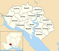
 England Southampton area location map.svg 170 × 147; 383 KB
-
 EnglandSouthampton.png 200 × 247; 29 KB
-

-
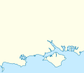
 Lageskizze von Clausentum und Hamwic (Southampton).png 912 × 960; 1.06 MB
-
 Location map United Kingdom Southampton Central.png 2,020 × 1,964; 2.6 MB
-
 Location map United Kingdom Southampton Central1.png 1,923 × 2,079; 2.66 MB
-

-
 Ordnance Survey One-Inch Sheet 180 The Solent, Published 1966.jpg 8,160 × 9,943; 10.51 MB
-
 Ordnance Survey One-Inch Sheet 180 The Solent, Published 1971.jpg 10,957 × 13,121; 42.48 MB
-
 Ordnance Survey One-Inch Tourist Map of the New Forest Published 1920.jpg 11,855 × 10,387; 14.64 MB
-
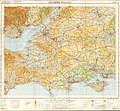 Ordnance Survey Quarter-inch Sheet 16 Southern England, Published 1966.jpg 9,646 × 8,909; 12.19 MB
-
 OS Map of Southampton--OldOS--.jpg 1,178 × 1,710; 1.2 MB
-
 OS Map SU41 extract.jpg 1,775 × 2,394; 4.33 MB
-
 Soton docks.gif 1,037 × 503; 51 KB
-
 South Hampshire Districts Map.svg 1,425 × 1,213; 1.23 MB
-
 Southampton constituencies.png 1,112 × 652; 86 KB
-
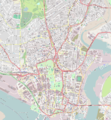
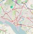
 Southampton from OpenStreetMap.png 460 × 394; 261 KB
-
 Southampton labelled ward map 2002.jpg 1,425 × 1,226; 251 KB
-
 Southampton labelled ward map 2002.svg 1,425 × 1,226; 275 KB
-
 Southampton Map.svg 1,146 × 1,179; 3.38 MB
-
 Southampton medieval plan.png 947 × 1,704; 494 KB
-
 Southampton medieval plan.svg 947 × 1,704; 199 KB
-
 Southampton OSM 01.png 469 × 405; 377 KB
-
 Southampton OSM 02.png 469 × 405; 457 KB
-
 Southampton OSM 03.png 630 × 544; 643 KB
-
 Southampton UK location map.svg 1,425 × 1,226; 248 KB
-
 Southampton UK locator map.svg 1,425 × 1,213; 1.23 MB
-
 Southampton UK ward map 2010 (blank).svg 1,425 × 1,226; 269 KB
-
 Southamptonmap.png 420 × 421; 41 KB
-
 Tourist plaque by the Bargate - geograph.org.uk - 1720239.jpg 640 × 486; 124 KB


,_1._bis_11._Jahrhundert_n._Chr..png)
.png)


.svg)