<nowiki>Category:Maps of Slavonia; categoría de Wikimedia; kategori Wikimedia; Wikimedia category; د ويکيمېډيا وېشنيزه; Vikimedya kategorisi; ویکیمیڈیا زمرہ; kategória projektov Wikimedia; категорія проєкту Вікімедіа; 维基媒体分类; Wikimedia-Kategorie; Викимедиина категорија; kategorija na Wikimediji; विकिपीडिया:श्रेणी; page de catégorie de Wikimedia; kategorija na Wikimediji; विकिपीडिया वर्ग; категорија на Викимедији; Wikimedia-Kategorie; Wikimedia-kategori; kategori Wikimédia; تصنيف ويكيميديا; pajenn rummata eus Wikimedia; Wikimedia:ကဏ္ဍခွဲခြင်း; 維基媒體分類; Wikimedia категориясы; categoría de Wikimedia; categoria de Wikimedia; Викимедиа категорияһы; tudalen categori Wikimedia; kategori e Wikimedias; Վիքիմեդիայի նախագծի կատեգորիա; 维基媒体分类; Wikimedia-kategori; ვიკიპედია:კატეგორიზაცია; ウィキメディアのカテゴリ; categoria Wikimedia; تصنيف بتاع ويكيميديا; විකිමීඩියා ප්රභේද පිටුව; categoria Vicimediorum; विकिमीडिया श्रेणी; Wikimedia-luokka; Wikimedia category; guruhi Vikimedia; катэгорыя ў праекце Вікімэдыя; Викимедиа проектындагы төркем; catigurìa di nu pruggettu Wikimedia; หน้าหมวดหมู่วิกิมีเดีย; Wikimedia:Kategorija; Wikimedia-Kategorie; Wikimedia:Klassys; категория на Уикимедия; categorie a unui proiect Wikimedia; 維基媒體分類; Wikimedia-kategori; kawan Wikimèdia; 維基媒體分類; 위키미디어 분류; Wikimedia-bólkur; kategorio en Vikimedio; kategori Wikimedia; Wikimedia:Ronnaghys; উইকিমিডিয়া বিষয়শ্রেণী; kategori Wikimedia; 维基媒体分类; וויקימעדיע קאַטעגאָריע; kategorija w projektach Wikimedije; thể loại Wikimedia; Wikimedia projekta kategorija; kategoria ti Wikimedia; categoria de um projeto da Wikimedia; Wikimedia category; категорияд Ангилал; Wikimedia-kategori; kategori Wikimedia; پۆلی ویکیمیدیا; Wikimedia category; Vikimédia ñemohenda; Wikimédia-kategória; વિકિપીડિયા શ્રેણી; Wikimediako kategoria; категория в проекте Викимедиа; Wikimedia-Kategorie; Kategoriya ning Wikimedia; Wikimedia-kategorie; Wîkîmediya:Kategorî; विकिमिडिया श्रेणी; Wikimedia-Kategorie; קטגוריה במיזמי ויקימדיה; Викимедиа проектындагы төркем; Wikimedia-categorie; विकिमिडिया श्रेणी; 维基媒体分类; Wikimedia-kategoriija; гурӯҳи Викимедиа; jamii ya Wikimedia; categoría de Wikimedia; Wikimedia-categorie; categoria di un progetto Wikimedia; катэгорыя ў праекце Вікімедыя; Wikimedia-categorie; categurìa 'e nu pruggette Wikimedia; 維基媒體分類; Vikipidiya:Shopni; Wikimedia-kategory; kategorya ng Wikimedia; гурӯҳи Викимедиа; ẹ̀ka Wikimedia; kategorie na projektech Wikimedia; categoria de um projeto da Wikimedia; Wikimedia-Kategorie; ردهٔ ویکیپدیا; tumbung Wikimedia; Wikimedia-kategorie; kategorija Wikimedie; Wikimedia proyektındağı törkem; Wikimedia-Kategorie; 维基媒体分类; kategori Wikimedia; kategoria w projekcie Wikimedia; വിക്കിമീഡിയ വർഗ്ഗം; 維基媒體分類; kategori Wikimedia; விக்கிமீடியப் பகுப்பு; زمرو:وڪيپيڊيا زمرا بندي; Wikimedia-Kategorie; categoría de Wikimedia; Viciméid catagóir; κατηγορία εγχειρημάτων Wikimedia; Wikimedia kategooria</nowiki>
Subcategories
This category has the following 7 subcategories, out of 7 total.

.jpg)


 Croatia minefields.png 330 × 355; 17 KB
 Croatia-Slavonia.png 1,288 × 1,231; 28 KB
 Croatia-Slavonija.png 200 × 198; 14 KB
 Croatia–Slavonia.png 200 × 198; 20 KB
 Donauschwaben Siedlungsgebiet.jpg 6,958 × 5,916; 15.78 MB
 Eastern Croatia map.png 1,880 × 2,353; 1.14 MB
 Map of Slavonia.png 640 × 489; 107 KB
 Non-Croats in Slavonia (2011 Census).png 1,080 × 596; 49 KB
 Serbs in Slavonia.jpg 1,072 × 590; 121 KB
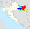 Slavonia 5 counties colour coded.svg 1,098 × 1,063; 427 KB
 Slavonia location map.svg 1,801 × 1,183; 72.98 MB
 Slavonia region cities map-sr.png 1,431 × 960; 62 KB
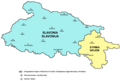 Slavonia region cities map.png 1,431 × 960; 68 KB
 Slavonia topo map OSM.png 1,188 × 781; 635 KB
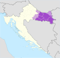 Slavonia.svg 1,098 × 1,063; 798 KB
 Slavonija.png 180 × 178; 25 KB
 Zajednica-opcina-Osijek-Karta.jpg 585 × 414; 33 KB


.png)


