中文(臺灣):臺北市士林區的地圖
<nowiki>Category:Maps of Shilin District, Taipei; categoría de Wikimedia; kategori Wikimedia; Wikimedia category; د ويکيمېډيا وېشنيزه; Vikimedya kategorisi; ویکیمیڈیا زمرہ; kategória projektov Wikimedia; категорія проєкту Вікімедіа; 维基媒体分类; Wikimedia-Kategorie; Викимедиина категорија; Wikimedia-Kategorie; विकिपीडिया:श्रेणी; page de catégorie de Wikimedia; kategorija na Wikimediji; विकिपीडिया वर्ग; категорија на Викимедији; Wikimedia-Kategorie; Wikimedia-kategori; kategori Wikimédia; تصنيف ويكيميديا; pajenn rummata eus Wikimedia; Wikimedia:ကဏ္ဍခွဲခြင်း; 維基媒體分類; Wikimedia категориясы; categoría de Wikimedia; categoria de Wikimedia; Wikimedia-Kategorie; tudalen categori Wikimedia; Viciméid catagóir; ردهٔ ویکیپدیا; 维基媒体分类; Wikimedia-kategory; ვიკიპედია:კატეგორიზაცია; ウィキメディアのカテゴリ; categoria Wikimedia; تصنيف بتاع ويكيميديا; විකිමීඩියා ප්රභේද පිටුව; categoria Vicimediorum; विकिमीडिया श्रेणी; Wikimedia-luokka; Wikimedia-categorie; guruhi Vikimedia; катэгорыя ў праекце Вікімэдыя; Викимедиа проектындагы төркем; catigurìa di nu pruggettu Wikimedia; หน้าหมวดหมู่วิกิมีเดีย; Wikimedia:Kategorija; Wikimedia-Kategorie; Wikimedia:Klassys; категория на Уикимедия; categorie a unui proiect Wikimedia; 維基媒體分類; Wikimedia-kategori; kawan Wikimèdia; гурӯҳи Викимедиа; 위키미디어 분류; Wikimedia-bólkur; kategorio en Vikimedio; kategori Wikimedia; Wikimedia:Ronnaghys; উইকিমিডিয়া বিষয়শ্রেণী; kategori Wikimedia; 维基媒体分类; וויקימעדיע קאַטעגאָריע; kategorija w projektach Wikimedije; thể loại Wikimedia; Wikimedia projekta kategorija; Wikimedia-kategorie; categoria de um projeto da Wikimedia; Wikimedia category; категорияд Ангилал; Wikimedia-kategori; kategori Wikimedia; پۆلی ویکیمیدیا; Wikimedia category; Vikimédia ñemohenda; Wikimédia-kategória; વિકિપીડિયા શ્રેણી; Wikimediako kategoria; категория в проекте Викимедиа; Wikimedia-Kategorie; Kategoriya ning Wikimedia; Wikimedia-kategorie; Wîkîmediya:Kategorî; विकिमिडिया श्रेणी; Wikimedia-Kategorie; קטגוריה במיזמי ויקימדיה; Викимедиа проектындагы төркем; Wikimedia-categorie; विकिमिडिया श्रेणी; κατηγορία εγχειρημάτων Wikimedia; Wikimedia-kategoriija; гурӯҳи Викимедиа; jamii ya Wikimedia; 維基媒體分類; categoría de Wikimedia; categoria di un progetto Wikimedia; விக்கிமீடியப் பகுப்பு; 维基媒体分类; categurìa 'e nu pruggette Wikimedia; Wikimedia kategooria; Wikimedia category; Wikimedia-kategori; Wikimedia proyektındağı törkem; 維基媒體分類; ẹ̀ka Wikimedia; kategorie na projektech Wikimedia; categoria de um projeto da Wikimedia; kategorija na Wikimediji; Վիքիմեդիայի նախագծի կատեգորիա; tumbung Wikimedia; kategoria ti Wikimedia; kategorija Wikimedie; kategorya ng Wikimedia; Викимедиа категорияһы; Wikimedia-Kategorie; kategori Wikimedia; kategoria w projekcie Wikimedia; വിക്കിമീഡിയ വർഗ്ഗം; 維基媒體分類; kategori Wikimedia; катэгорыя ў праекце Вікімедыя; زمرو:وڪيپيڊيا زمرا بندي; Vikipidiya:Shopni; categoría de Wikimedia; Wikimedia-categorie; 维基媒体分类; kategori e Wikimedias</nowiki>
Subcategories
This category has only the following subcategory.


 CTOYAC and surrounding areas map 20060918.png 1,845 × 1,280; 607 KB
 Map of Taipei Astronomical Museum and Meilun Science Park 20080806.jpg 2,592 × 1,944; 681 KB
 Shilin District Location.PNG 858 × 1,101; 58 KB
 Shilin location.jpg 124 × 157; 4 KB
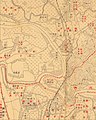 Shilin, Taiwan Hōzu (cropped).jpg 1,834 × 2,292; 2.02 MB
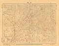 Shilin, Taiwan Hōzu.jpg 6,833 × 5,331; 16.33 MB
 Shirin Town.png 1,715 × 1,642; 1.57 MB
 TaipeiShihlinDistrict.png 350 × 461; 21 KB
 TaipeiShiLinSubDistrictMap.png 716 × 654; 12 KB
 士商路 - panoramio - Tianmu peter (19).jpg 1,944 × 2,592; 722 KB
 士林官邸參觀攝影 - panoramio - Tianmu peter (10).jpg 2,592 × 1,944; 769 KB
 士林都市更新區域.PNG 658 × 440; 391 KB
 文林苑位置圖-a.png 753 × 582; 87 KB
 文林苑協商平台 方案2-1.PNG 736 × 491; 418 KB
 文林苑原老舊建築說明.jpg 306 × 279; 49 KB
 文林苑建築平面圖.jpg 318 × 279; 46 KB
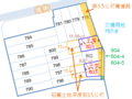 文林苑王家原地重建A.PNG 811 × 610; 81 KB
 新天母快速道路規劃.png 1,147 × 878; 123 KB
 草山市區計畫平面圖.jpg 2,480 × 3,543; 671 KB


.jpg)


.jpg)
.jpg)


