Category:Maps of Schiedam
Jump to navigation
Jump to search
Wikimedia category | |||||
| Upload media | |||||
| Instance of | |||||
|---|---|---|---|---|---|
| Category combines topics | |||||
| Schiedam | |||||
city and municipality in the Netherlands    .svg) | |||||
| Pronunciation audio | |||||
| Instance of |
| ||||
| Location | South Holland, Netherlands | ||||
| Located in or next to body of water | |||||
| Inception |
| ||||
| Population |
| ||||
| Area |
| ||||
| Replaces | |||||
| official website | |||||
 | |||||
Subcategories
This category has the following 3 subcategories, out of 3 total.
M
- Maps of Kethel en Spaland (2 F)
O
- Old maps of Schiedam (11 F)
Media in category "Maps of Schiedam"
The following 34 files are in this category, out of 34 total.
-
 2013-Schiedam.jpg 1,259 × 1,620; 1.44 MB
-
 4schieen.jpg 213 × 239; 10 KB
-
 Babberspolder1712.JPG 420 × 274; 34 KB
-
 BAG woonplaatsen - Gemeente Schiedam.png 2,419 × 2,419; 647 KB
-
 Gem-Schiedam-2014Q1.jpg 2,375 × 3,130; 3.92 MB
-
 Gem-Schiedam-OpenTopo.jpg 1,965 × 2,887; 1,011 KB
-
 Hoekwater polderkaart - Babberspolder.PNG 497 × 533; 647 KB
-
 Hoekwater polderkaart - Hargpolder.PNG 383 × 318; 299 KB
-
 Hoekwater polderkaart - Holierhoekse- en Zouteveense polder.PNG 424 × 531; 464 KB
-
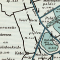 Hoekwater polderkaart - Noord Ketel polder.PNG 438 × 442; 450 KB
-
 Hoekwater polderkaart - Oost Abts polder.PNG 589 × 459; 659 KB
-
 Hoekwater polderkaart - Oud en Nieuw West Frankenland.PNG 528 × 462; 650 KB
-
 Hoekwater polderkaart - Spaanse Polder.PNG 371 × 361; 351 KB
-
 Hoekwater polderkaart - West Abts polder.PNG 526 × 405; 532 KB
-
 Holierhoeksepolder1712.JPG 629 × 407; 73 KB
-
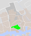
 LocatieSchiedam.png 280 × 130; 10 KB
-
 Map - NL - Schiedam (2009).svg 625 × 575; 2.59 MB
-
 Map NL - Schiedam (2007) - Spaland.PNG 462 × 537; 24 KB
-
 Map NL - Schiedam (2007) - Woudhoek.PNG 462 × 537; 24 KB
-
 Mathenesse1611.jpg 767 × 1,337; 421 KB
-
 Nieuwlandsche polder1712.JPG 515 × 319; 50 KB
-
 Noord Kethelse polder1712.JPG 492 × 411; 61 KB
-
 Rijksbeschermd stads- of dorpsgezicht - Schiedam.png 2,016 × 2,267; 252 KB
-
 Risicokaart Schiedam meerwaarde combineren datasets.PNG 1,099 × 918; 452 KB
-
 Schiedam-centrum-OpenTopo.jpg 3,518 × 3,326; 4.29 MB
-
 Schiedam-graveland.png 462 × 537; 24 KB
-
 Schiedam-groenoord.png 462 × 537; 24 KB
-
 Schiedam-nieuwland.png 462 × 537; 24 KB
-
 Schiedam-oost.png 462 × 537; 24 KB
-
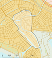
 Schiedam-plaats-OpenTopo.jpg 1,795 × 2,031; 2.37 MB
-
 Schiedam-stad-2014Q1.jpg 1,795 × 2,031; 2.27 MB
-
 Schiedam-west.png 462 × 537; 24 KB
-
 Schiedam-zuid.png 462 × 537; 24 KB
-
 Vlaardingen-Schiedam-topografie.jpg 1,899 × 1,607; 2.31 MB


.svg)
_-_Spaland.PNG)
_-_Woudhoek.PNG)


