<nowiki>Category:Maps of San Juan County, New Mexico; categoría de Wikimedia; kategori Wikimedia; Wikimedia category; د ويکيمېډيا وېشنيزه; Vikimedya kategorisi; ویکیمیڈیا زمرہ; kategória projektov Wikimedia; категорія проєкту Вікімедіа; 维基媒体分类; Wikimedia-Kategorie; Викимедиина категорија; Wikimedia-Kategorie; विकिपीडिया:श्रेणी; page de catégorie de Wikimedia; kategorija na Wikimediji; विकिपीडिया वर्ग; категорија на Викимедији; Wikimedia-Kategorie; Wikimedia-kategori; kategori Wikimédia; تصنيف ويكيميديا; pajenn rummata eus Wikimedia; Wikimedia:ကဏ္ဍခွဲခြင်း; 維基媒體分類; Wikimedia категориясы; categoría de Wikimedia; Wikimedia-Kategorie; Wikimedia-Kategorie; tudalen categori Wikimedia; Viciméid catagóir; ردهٔ ویکیپدیا; 维基媒体分类; Wikimedia-kategory; ვიკიპედია:კატეგორიზაცია; ウィキメディアのカテゴリ; categoria Wikimedia; تصنيف بتاع ويكيميديا; විකිමීඩියා ප්රභේද පිටුව; categoria Vicimediorum; विकिमीडिया श्रेणी; Wikimedia-luokka; Wikimedia category; விக்கிமீடியப் பகுப்பு; катэгорыя ў праекце Вікімэдыя; Викимедиа проектындагы төркем; catigurìa di nu pruggettu Wikimedia; หน้าหมวดหมู่วิกิมีเดีย; Wikimedia:Kategorija; Wikimedia-Kategorie; Wikimedia:Klassys; категория на Уикимедия; categorie a unui proiect Wikimedia; 維基媒體分類; Wikimedia-kategori; kawan Wikimèdia; 維基媒體分類; 위키미디어 분류; Wikimedia-bólkur; kategorio en Vikimedio; kategori Wikimedia; Wikimedia:Ronnaghys; উইকিমিডিয়া বিষয়শ্রেণী; kategori Wikimedia; 维基媒体分类; וויקימעדיע קאַטעגאָריע; kategorija w projektach Wikimedije; thể loại Wikimedia; Wikimedia projekta kategorija; kategoria ti Wikimedia; categoria de um projeto da Wikimedia; Wikimedia category; категорияд Ангилал; Wikimedia-kategori; kategori Wikimedia; پۆلی ویکیمیدیا; Wikimedia category; Vikimédia ñemohenda; Wikimédia-kategória; વિકિપીડિયા શ્રેણી; Wikimediako kategoria; категория в проекте Викимедиа; Wikimedia-Kategorie; Kategoriya ning Wikimedia; Wikimedia-kategorie; Wîkîmediya:Kategorî; विकिमिडिया श्रेणी; Wikimedia-Kategorie; קטגוריה במיזמי ויקימדיה; Викимедиа проектындагы төркем; kategoria w projekcie Wikimedia; विकिमिडिया श्रेणी; κατηγορία εγχειρημάτων Wikimedia; Wikimedia-kategoriija; гурӯҳи Викимедиа; 維基媒體分類; categoría de Wikimedia; 維基媒體分類; categoria di un progetto Wikimedia; Vikipidiya:Shopni; 维基媒体分类; categurìa 'e nu pruggette Wikimedia; Wikimedia kategooria; Վիքիմեդիայի նախագծի կատեգորիա; Викимедиа категорияһы; Wikimedia proyektındağı törkem; гурӯҳи Викимедиа; ẹ̀ka Wikimedia; kategorie na projektech Wikimedia; categoria de um projeto da Wikimedia; kategorija na Wikimediji; categoria de Wikimedia; tumbung Wikimedia; Wikimedia-kategorie; kategorija Wikimedie; kategorya ng Wikimedia; Wikimedia-categorie; катэгорыя ў праекце Вікімедыя; kategori Wikimedia; jamii ya Wikimedia; വിക്കിമീഡിയ വർഗ്ഗം; Wikimedia-categorie; kategori Wikimedia; Wikimedia-categorie; زمرو:وڪيپيڊيا زمرا بندي; kategori e Wikimedias; categoría de Wikimedia; Wikimedia-kategori; 维基媒体分类; guruhi Vikimedia</nowiki>


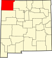 Map of New Mexico highlighting San Juan County.svg 5,677 × 6,312; 31 KB
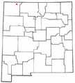 NMMap-doton-Aztec.PNG 271 × 300; 19 KB
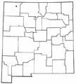 NMMap-doton-Bloomfield.PNG 271 × 300; 19 KB
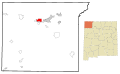
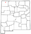 NMMap-doton-Farmington.PNG 271 × 300; 19 KB
 NMMap-doton-FloraVista.PNG 271 × 300; 19 KB
 NMMap-doton-Kirtland.PNG 271 × 300; 19 KB
 NMMap-doton-Nageezi.PNG 271 × 300; 19 KB
 NMMap-doton-Naschitti.PNG 271 × 300; 19 KB
 NMMap-doton-Newcomb.PNG 271 × 300; 19 KB
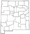 NMMap-doton-Sanostee.PNG 271 × 300; 19 KB
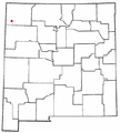 NMMap-doton-SheepSprings.PNG 271 × 300; 19 KB
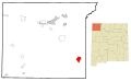
 NMMap-doton-Shiprock.PNG 271 × 300; 19 KB