Category:Maps of Saint John, United States Virgin Islands
Jump to navigation
Jump to search
Media in category "Maps of Saint John, United States Virgin Islands"
The following 6 files are in this category, out of 6 total.
-
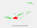 Caribbean - Saint John.PNG 627 × 481; 9 KB
-
 A map of the Island of St John - Holland - btv1b53090017j.jpg 9,083 × 4,856; 7.4 MB
-
 NPS virgin-islands-st-john-map.jpg 2,095 × 1,490; 681 KB
-
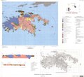 St. John, USVI, geologic map.pdf 6,564 × 5,991; 2.53 MB
-
 USGS geologic map St John USVI.png 872 × 1,099; 217 KB
-
 USVI - St. John - Coral Bay - Map from 1720.jpg 6,831 × 5,525; 3.89 MB


