Category:Maps of Rheda-Wiedenbrück
Jump to navigation
Jump to search
Kreis Gütersloh  Borgholzhausen · Gütersloh · Halle · Harsewinkel · Herzebrock-Clarholz · Langenberg · Rheda-Wiedenbrück · Rietberg · Schloß Holte-Stukenbrock · Steinhagen · Verl · Versmold · Werther ·
Wikimedia category | |||||
| Upload media | |||||
| Instance of | |||||
|---|---|---|---|---|---|
| Category combines topics | |||||
| Rheda-Wiedenbrück | |||||
town in the district of Gütersloh, in North Rhine-Westphalia, Germany     | |||||
| Instance of |
| ||||
| Location | |||||
| Located in or next to body of water | |||||
| Visitor center | |||||
| Head of government |
| ||||
| Population |
| ||||
| Area |
| ||||
| Elevation above sea level |
| ||||
| official website | |||||
 | |||||
Media in category "Maps of Rheda-Wiedenbrück"
The following 17 files are in this category, out of 17 total.
-
 Admin Rheda-Wiedenbrueck.svg 446 × 387; 102 KB
-
 Karfreitag route.jpg 395 × 451; 47 KB
-
 Lage der Stadt Rheda-Wiedenbrück in Deutschland.png 188 × 235; 5 KB
-
 Lage Rheda-Wiedenbrück im Kreis Gütersloh.png 438 × 435; 22 KB
-
 North rhine w gt Rheda-Wiedenbrueck.png 830 × 830; 317 KB
-
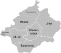
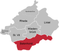 Ortsteile Rheda-Wiedenbrück - Batenhorst.svg 446 × 387; 102 KB
-
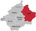 Ortsteile Rheda-Wiedenbrück - Lintel.svg 446 × 387; 102 KB
-
 Ortsteile Rheda-Wiedenbrück - Rheda.svg 446 × 387; 102 KB
-
 Ortsteile Rheda-Wiedenbrück - St. Vit.svg 446 × 387; 102 KB
-
 Ortsteile Rheda-Wiedenbrück - Wiedenbrück.svg 446 × 387; 102 KB
-
 Rheda-Wiedenbrück - nature reserves.png 1,249 × 1,150; 1.61 MB
-
 Rheda-Wiedenbrück - NSG Am Merschgraben - Map.png 875 × 644; 260 KB
-
 Rheda-Wiedenbrück - NSG Am Merschgraben - Map.svg 629 × 501; 368 KB
-
 Rheda-Wiedenbrück - NSG Erlenbruch und Schlosswiesen Rheda - Map.png 943 × 868; 501 KB
-
 Rheda-Wiedenbrück - NSG Erlenbruch und Schlosswiesen Rheda - Map.svg 777 × 582; 458 KB
-
 Rheda-Wiedenbrück geothermische Karte.png 600 × 580; 32 KB
-
 Rheda-Wiedenbrück in GT.svg 485 × 470; 301 KB


