Category:Maps of Putnam County, Illinois
Jump to navigation
Jump to search
Counties of Illinois: Adams · Alexander · Bond · Boone · Brown · Bureau · Calhoun · Carroll · Cass · Champaign · Christian · Clark · Clay · Clinton · Coles · Cook · Crawford · Cumberland · DeKalb · DeWitt · Douglas · DuPage · Edgar · Edwards · Effingham · Fayette · Ford · Franklin · Fulton · Gallatin · Greene · Grundy · Hamilton · Hancock · Hardin · Henderson · Henry · Iroquois · Jackson · Jasper · Jefferson · Jersey · Jo Daviess · Johnson · Kane · Kankakee · Kendall · Knox · Lake · LaSalle · Lawrence · Lee · Livingston · Logan · Macon · Macoupin · Madison · Marion · Marshall · Mason · Massac · McDonough · McHenry · McLean · Menard · Mercer · Monroe · Montgomery · Morgan · Moultrie · Ogle · Peoria · Perry · Piatt · Pike · Pope · Pulaski · Putnam · Randolph · Richland · Rock Island · St. Clair · Saline · Sangamon · Schuyler · Scott · Shelby · Stark · Stephenson · Tazewell · Union · Vermilion · Wabash · Warren · Washington · Wayne · White · Whiteside · Will · Williamson · Winnebago · Woodford
Wikimedia category | |||||
| Upload media | |||||
| Instance of | |||||
|---|---|---|---|---|---|
| Category combines topics | |||||
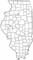
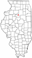
| Putnam County | |||||
county in Illinois, United States   | |||||
| Instance of | |||||
| Named after | |||||
| Location | Illinois | ||||
| Capital | |||||
| Inception |
| ||||
| Population |
| ||||
| Area |
| ||||
| Different from | |||||
| official website | |||||
 | |||||
Subcategories
This category has only the following subcategory.
Media in category "Maps of Putnam County, Illinois"
The following 23 files are in this category, out of 23 total.
-
 ILMap-doton-Granville.PNG 167 × 300; 24 KB
-
 ILMap-doton-Hennepin.PNG 167 × 300; 24 KB
-
 ILMap-doton-Magnolia.PNG 167 × 300; 24 KB
-
 ILMap-doton-Mark.PNG 167 × 300; 24 KB
-
 ILMap-doton-McNabb.PNG 167 × 300; 24 KB
-
 Map highlighting Granville Township, Putnam County, Illinois.svg 512 × 512; 26 KB
-
 Map highlighting Hennepin Township, Putnam County, Illinois.svg 512 × 512; 30 KB
-
 Map highlighting Magnolia Township, Putnam County, Illinois.svg 512 × 512; 32 KB
-
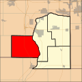 Map highlighting Senachwine Township, Putnam County, Illinois.svg 512 × 512; 35 KB
-
 Map of Illinois highlighting Putnam County.svg 3,453 × 6,157; 85 KB
-
 Ottawa-Streator Micropolitan Area.png 298 × 494; 20 KB
-
 Putnam County Blank.PNG 456 × 407; 9 KB
-
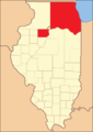
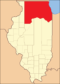 Putnam County Illinois 1825.png 288 × 405; 9 KB
-
 Putnam County Illinois 1827.png 288 × 405; 9 KB
-
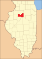
 Putnam County Illinois 1831.png 288 × 405; 9 KB
-
 Putnam County Illinois 1837.png 288 × 405; 9 KB
-
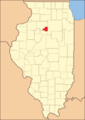 Putnam County Illinois 1839.png 288 × 405; 10 KB
-

-

-

-

-

-


