Category:Maps of Pune
Jump to navigation
Jump to search
Media in category "Maps of Pune"
The following 10 files are in this category, out of 10 total.
-
 19th-century map of Pune city.jpg 1,658 × 2,715; 867 KB
-
 Map India and Pakistan 1-250,000 Tile NE 43-6 Poona and Vicinity (verso).jpg 5,000 × 3,771; 1.28 MB
-
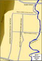 Map of Baner Pashan Link Road.png 740 × 1,055; 136 KB
-
 Poona 1896.jpg 2,048 × 1,263; 818 KB
-
 Poona and Kirkee Cantonment 1896.jpg 2,819 × 3,653; 1.89 MB
-
 Poona Kirkee.jpg 565 × 901; 100 KB
-
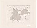
 Pune area locator map.png 1,876 × 2,100; 834 KB
-
 Pune Cantonement Road Map (1).jpg 960 × 1,280; 94 KB
-
 Pune Cantonment Map.png 1,693 × 2,340; 815 KB
-
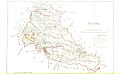
 Pune Poona 1911 map.jpg 1,596 × 1,970; 358 KB

.jpg)


.jpg)

