Category:Maps of Paris in the 1710s
Jump to navigation
Jump to search
Subcategories
This category has the following 4 subcategories, out of 4 total.
Media in category "Maps of Paris in the 1710s"
The following 20 files are in this category, out of 20 total.
-
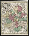
 1710 – Carte de la Prévosté et Vicomté de Paris gravée par Matth. Seutter.jpg 7,120 × 6,000; 29.06 MB
-
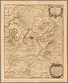
 1711 - Carte de la Prevosté et Vicomté de Paris - Open Data Hauts-de-Seine.jpg 8,432 × 6,568; 8.89 MB
-
 1714 - Diocèse de l'Archevesché de Paris - Open Data Hauts-de-Seine.jpg 6,371 × 8,877; 43.28 MB
-
-
 1717 - La prévôté et l'Eslection de Paris. 1717 - Open Data Hauts-de-Seine.jpg 8,864 × 6,777; 9.78 MB
-
 Atlas curieux, by Nicolas de Fer, 1703 (9752058).jpg 8,695 × 5,859; 16.19 MB
-

-
 Atlas ou recueil de cartes géographiques - Diocese de l'archevesche de Paris - David Rumsey.jpg 12,860 × 15,589; 86.56 MB
-

-

-

-
 Guillaume de L’Isle, Plan de la ville et fauxbourgs de Paris, 1716 - McMaster University.jpg 16,240 × 12,431; 87.12 MB
-
 Hiérarchie des boucheries en 1714 - ALPAGE.pdf 1,752 × 1,239; 283 KB
-
 Le plan de Paris, ses Faubourgs et ses environs by Guillaume de L'Isle - Stanford Libraries.jpg 13,336 × 9,832; 27.89 MB
-
-

-
 Nicolas de Fer, La banlieue de Paris, 1717 - Gallica.jpg 9,854 × 7,712; 23.11 MB
-
 Nouveau plan de la ville, cité et université de Paris by Claude Roussel, 1716 - Gallica.jpg 13,254 × 9,569; 33.17 MB
-

-
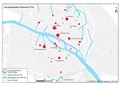
 Plan du réseau d'adduction de l'eau publique à Paris au XVIIIe siècle.JPG 1,401 × 1,019; 373 KB


.jpg)


.jpg)
