Category:Maps of Palestine and Jordan by Gottlieb Schumacher
Jump to navigation
Jump to search
Media in category "Maps of Palestine and Jordan by Gottlieb Schumacher"
The following 25 files are in this category, out of 25 total.
-
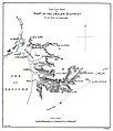 1885 map of the Sea of Galilee and part of the Golan.jpg 3,385 × 3,963; 1.29 MB
-
 Baalbek-G.Sumacher.jpg 2,998 × 3,096; 1.42 MB
-
 Banias in Schumacher Ostjordanlandes A2 (cropped).jpg 2,402 × 1,206; 941 KB
-
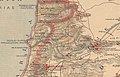
 Eastern Jaulan and Western Hauran, 1888.jpg 7,087 × 4,676; 4.41 MB
-
 Gottlieb Schumacher. Karte des Ostjordanlandes Blatt I. 1900.jpg 1,024 × 1,200; 249 KB
-
 Hippos in the Schumacher Ostjordanlandes map.jpg 2,518 × 1,623; 1.77 MB
-
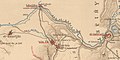
 Jisr el Mejami and Baqoura in Schumacher's maps.jpg 1,548 × 1,354; 636 KB
-
 Jisr es Saghir in Schumacher Ostjordanlandes A4 (cropped).jpg 2,858 × 2,783; 2.24 MB
-
 Jisr es Sidd and Jisr Umm el-Kanatir in Schumacher's maps.jpg 1,416 × 1,973; 1.16 MB
-
 Karte des Ostjordanlandes.jpg 22,772 × 20,864; 364.37 MB
-
-
 Qasr Bardawil and Jdeiye in Schumacher Ostjordanlandes A3 (cropped).jpg 1,153 × 1,100; 516 KB
-
 Schumacher Ostjordanlandes A2.jpg 9,835 × 10,790; 19.13 MB
-
 Schumacher Ostjordanlandes A3.jpg 9,136 × 8,525; 17.72 MB
-
 Schumacher Ostjordanlandes A4.jpg 10,221 × 8,583; 17.22 MB
-
 Schumacher Ostjordanlandes A5.jpg 10,428 × 11,310; 21.92 MB
-
 Schumacher Ostjordanlandes B3.jpg 12,330 × 8,542; 17.71 MB
-
 Schumacher Ostjordanlandes B4.jpg 9,728 × 8,523; 14.73 MB
-
 Schumacher Ostjordanlandes B5.jpg 10,322 × 11,262; 17.97 MB
-
 Schumacher Ostjordanlandes C4.jpg 9,900 × 8,462; 11.8 MB
-
 Schumacher Ostjordanlandes Key.jpg 6,694 × 8,213; 12.3 MB
-
 Schumacher's map of the Golan.jpg 3,495 × 5,008; 1.87 MB
-
 SchumacherElHamma.png 2,000 × 1,791; 495 KB
-
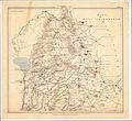
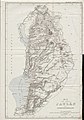
 Sketch Map of a part of Southern Palestine, 1886.jpg 3,455 × 3,185; 1.45 MB
-
 חיספין במפה של גוטליב שומאכר מ-1885.jpg 461 × 405; 70 KB


.jpg)


.jpg)


.jpg)
.jpg)


