Category:Maps of Nonthaburi Province
Jump to navigation
Jump to search
Wikimedia category | |||||
| Upload media | |||||
| Instance of | |||||
|---|---|---|---|---|---|
| Category combines topics | |||||
| Nonthaburi | |||||
province in central Thailand      | |||||
| Instance of |
| ||||
| Part of | |||||
| Location | Thailand | ||||
| Located in or next to body of water | |||||
| Capital | |||||
| Official language | |||||
| Currency | |||||
| Founded by |
| ||||
| Population |
| ||||
| Area |
| ||||
| official website | |||||
 | |||||
Subcategories
This category has only the following subcategory.
E
Media in category "Maps of Nonthaburi Province"
The following 24 files are in this category, out of 24 total.
-
 2020 Nonthaburi PAO Election Map.png 2,000 × 2,384; 190 KB
-
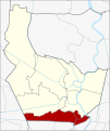
 Amphoe 1201.png 270 × 292; 8 KB
-
 Amphoe 1201.svg 1,595 × 1,901; 540 KB
-
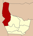
 Amphoe 1202.png 270 × 292; 8 KB
-
 Amphoe 1202.svg 1,595 × 1,901; 538 KB
-
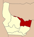
 Amphoe 1203.png 270 × 290; 8 KB
-
 Amphoe 1203.svg 1,595 × 1,901; 544 KB
-
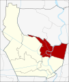
 Amphoe 1204.png 270 × 290; 8 KB
-
 Amphoe 1204.svg 1,595 × 1,901; 549 KB
-
 Amphoe 1205.png 270 × 290; 8 KB
-
 Amphoe 1205.svg 1,595 × 1,901; 543 KB
-
 Amphoe 1206.png 270 × 290; 8 KB
-
 Amphoe 1206.svg 1,595 × 1,901; 549 KB
-
 Amphoe Nonthaburi With Colours.png 1,594 × 1,900; 439 KB
-
 Amphoe Nonthaburi.png 405 × 435; 16 KB
-
 Amphoe Nonthaburi.svg 1,595 × 1,901; 545 KB
-
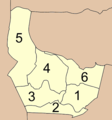
 Districts Nonthaburi.png 859 × 1,024; 187 KB
-
 Municipal Areas in Nonthaburi Province EN.png 1,595 × 1,901; 508 KB
-
 Municipal Areas in Nonthaburi Province TH.png 1,595 × 1,901; 504 KB
-
 Nonthaburi PESA.svg 1,595 × 1,901; 549 KB
-
 Pak Kret map.svg 761 × 776; 1.44 MB
-
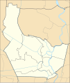 Thailand Nonthaburi location map.svg 1,595 × 1,901; 536 KB
-
 Thailand Nonthaburi locator map.svg 1,052 × 1,849; 1.24 MB
-
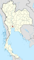
 Thailand Nonthaburi.png 178 × 300; 14 KB


