Category:Maps of Nice
Jump to navigation
Jump to search
Wikimedia category | |||||
| Upload media | |||||
| Instance of | |||||
|---|---|---|---|---|---|
| Category combines topics | |||||
| Nice | |||||
city and commune in Alpes-Maritimes, Provence-Alpes-Côte d'Azur, France      | |||||
| Instance of | |||||
| Patron saint | |||||
| Location | arrondissement of Nice, Alpes-Maritimes, Provence-Alpes-Côte d'Azur, Metropolitan France, France | ||||
| Located in or next to body of water | |||||
| Official language | |||||
| Head of government |
| ||||
| Significant event |
| ||||
| Population |
| ||||
| Area |
| ||||
| Elevation above sea level |
| ||||
| Different from | |||||
| official website | |||||
 | |||||
Français : Les cartes datant de plus de 70 ans sont à placer dans la sous-catégorie "Old maps of Nice"
Subcategories
This category has the following 6 subcategories, out of 6 total.
*
- Locator maps of Nice Quarters (62 F)
2
- Maps of 2016 Nice attack (7 F)
A
- Attraction maps of Nice (2 F)
O
T
- Tram maps of Nice (45 F)
Media in category "Maps of Nice"
The following 55 files are in this category, out of 55 total.
-
 06 ALPES-MARITIMES carte grille communale densite INSEE.png 3,507 × 2,480; 1.47 MB
-
 06-AAV2020-Nice.png 3,519 × 3,197; 1.13 MB
-
 06-Alpes-Maritimes-unité-urbaine-Nice.png 3,519 × 2,930; 1.1 MB
-
 06088-Nice-Hydro.jpeg 5,846 × 4,133; 3.48 MB
-
 06088-Nice-Sols.png 3,270 × 2,598; 7.4 MB
-
 2016 Nice attack annotated.jpeg 3,161 × 1,511; 3.06 MB
-
 2016 Nice attack.png 2,554 × 1,527; 2.7 MB
-
 3e circonscription Alpes-Maritimes - découpage 1986.jpg 415 × 352; 33 KB
-
 3e circonscription Alpes-Maritimes - découpage 2010.jpg 415 × 352; 32 KB
-
 Arrondissements de Grasse et Nice in Alpes-Maritime locator map.svg 1,708 × 1,939; 108 KB
-
 Atentado Niza.jpg 1,300 × 771; 474 KB
-
 Carrefour du 28 aout 1944 - Nice.jpg 1,196 × 1,244; 221 KB
-
 Carrefour du 28 aout 1944 - sur un plan de 1943 - Nice.jpg 1,196 × 1,244; 221 KB
-
 Carte de NICE SMART VALLEY.png 653 × 390; 194 KB
-
 Circonscriptions législatives (1988-) Nice.jpg 415 × 352; 34 KB
-
 Circonscriptions législatives (1988-2007) Nice.jpg 415 × 352; 31 KB
-
 Circonscriptions législatives (2012-) Nice.jpg 415 × 352; 31 KB
-
 CommunesAlpesMaritimesNice.png 450 × 515; 26 KB
-
 Comté Nice 1789.svg 2,000 × 1,922; 798 KB
-
 Cultures en europe de l'ouest.png 1,152 × 1,477; 76 KB
-
 Diocèse Nice 1789.svg 2,000 × 1,922; 801 KB
-
 Début et fin de l'attaque.png 1,852 × 936; 611 KB
-
 France militaire 1836 TIII 157024.jpg 2,960 × 2,211; 1.15 MB
-
 Jaures046 map.jpg 150 × 141; 8 KB
-
 Map commune FR insee code 06088.png 756 × 605; 115 KB
-
 Map Nice.jpg 1,914 × 2,075; 2.66 MB
-
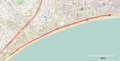
 Map of Nice transport.jpg 1,262 × 864; 230 KB
-
 Mapa Niça comtat.PNG 648 × 429; 6 KB
-
 Nice dot.png 1,804 × 1,689; 164 KB
-
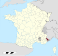
 Nice in France.png 280 × 278; 41 KB
-
 Nice Limite administrative.jpg 951 × 577; 189 KB
-
 Nice Limite de la ville.jpg 956 × 578; 175 KB
-
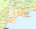
 Nice OSM 01.png 465 × 531; 200 KB
-
 Nice OSM 02.png 465 × 531; 304 KB
-
 Nice ville de la villégiature d’hiver de riviera map-fr.svg 650 × 650; 1.13 MB
-
 Nice-attacks-2016.png 1,852 × 936; 267 KB
-
 Nice-VieilleVille--Histoire-PlaceGaribaldi-avant.jpg 500 × 426; 139 KB
-
 NiceAutoBleu.png 1,987 × 1,833; 2.8 MB
-
 NIK-Synoptic-Saleya.jpg 421 × 600; 41 KB
-
 NIKAIA-Massena--schema.jpg 748 × 1,016; 98 KB
-
 NIKAIA-Medecin--schema.jpg 564 × 1,121; 230 KB
-
 NIKAIA-Medecin-Plan.jpg 558 × 1,170; 181 KB
-
 NIKAIA-Port-Carte.gif 770 × 972; 375 KB
-
 NIKAIA-Providence-schema.jpg 600 × 468; 45 KB
-
 NIKAIA-ReparateAR-Map.jpg 800 × 574; 90 KB
-
 NIKAIA-Saleya-schema.jpg 874 × 1,230; 163 KB
-
 Place Garibaldi map.jpg 806 × 610; 73 KB
-
 Plan carrefour du 28 aout 1944.jpg 3,996 × 3,481; 808 KB
-
 Plan XIIe de Nice.jpg 2,575 × 1,507; 947 KB
-

-
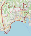
 QuartiersNiceArenas.svg 947 × 720; 384 KB
-
 Saint-André-de-la-Roche OSM 02.png 514 × 755; 418 KB
-
 Decoupage territorial Nice.jpg 850 × 1,141; 156 KB
-
 尼斯街区地图.png 582 × 649; 74 KB
-
 Tirs sur le château de Nice.jpg 1,705 × 2,366; 414 KB


_Nice.jpg)
_Nice.jpg)
_Nice.jpg)


_Les_Forces_de_l%27Europe,_Asie,_Afrique_et_Amerique,_ou_description_des_principales_villes_avec_leurs_fortific,_RP-P-OB-83.034-175.jpg)


