Category:Maps of Nantucket
Jump to navigation
Jump to search
Counties of Massachusetts: Barnstable · Berkshire · Bristol · Dukes · Essex · Franklin · Hampden · Hampshire · Middlesex · Nantucket · Norfolk · Plymouth · Suffolk · Worcester
Wikimedia category | |||||
| Upload media | |||||
| Instance of | |||||
|---|---|---|---|---|---|
| Category combines topics | |||||
| Nantucket | |||||
island of Massachusetts, United States      | |||||
| Instance of | |||||
| Location | New England | ||||
| Located in or next to body of water | |||||
| Highest point |
| ||||
| Population |
| ||||
| Area |
| ||||
| Elevation above sea level |
| ||||
| Different from | |||||
| Said to be the same as | Nantucket County | ||||
| official website | |||||
 | |||||
Subcategories
This category has the following 2 subcategories, out of 2 total.
O
- Old maps of Nantucket (57 F)
Media in category "Maps of Nantucket"
The following 22 files are in this category, out of 22 total.
-
-

-
 Birds eye view of the town of Nantucket, State of Massachusetts (2675002280).jpg 2,000 × 1,399; 2.33 MB
-
 Cape and Islands towns.png 3,600 × 4,200; 289 KB
-
 Chart USCGS 1107 (NOAA 13200) Nantucket Shoals.jpg 6,911 × 4,955; 1.77 MB
-
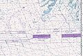 Chart1.jpg 700 × 480; 81 KB
-
 Ma10 109.gif 636 × 379; 33 KB
-
 Map of Massachusetts highlighting Nantucket County.svg 2,976 × 1,819; 43 KB
-
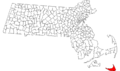
 Massachusetts location Nantucket.svg 500 × 314; 176 KB
-

-

-

-
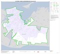
 Nantucket County Massachusetts incorporated and unincorporated areas.svg 1,070 × 670; 1.37 MB
-
 Nantucket County, Massachusetts LOC 81690021.jpg 3,324 × 2,690; 1.4 MB
-
 Nantucket County, Massachusetts LOC 81690021.tif 3,324 × 2,690; 25.58 MB
-
 Nantucket ma highlight.png 788 × 466; 54 KB
-
 Nantucket map-fi.png 4,490 × 2,700; 2.52 MB
-
 Nantucket Shoals NOAA chart 12300.gif 762 × 746; 46 KB
-
 Nantucket, Massachusetts.jpg 5,034 × 3,344; 1.25 MB
-
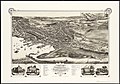
 The American Museum journal (c1900-(1918)) (18157802452).jpg 1,898 × 958; 261 KB
-
 USA MA Cape Islands.svg 304 × 304; 54 KB
-
 Wôpanâak Nation c 1620-01.svg 512 × 374; 79 KB
.jpg)
.jpg)

_Nantucket_Shoals.jpg)


_highlighted.svg)


)_(18157802452).jpg)

