Category:Maps of Nîmes
Jump to navigation
Jump to search
Wikimedia category | |||||
| Upload media | |||||
| Instance of | |||||
|---|---|---|---|---|---|
| Category combines topics | |||||
| Nîmes | |||||
city and prefecture of the Gard department in the Occitanie region of Southern France   .svg)  | |||||
| Instance of | |||||
| Location |
| ||||
| Head of government |
| ||||
| Population |
| ||||
| Area |
| ||||
| Elevation above sea level |
| ||||
| Replaces |
| ||||
| official website | |||||
 | |||||
Subcategories
This category has the following 5 subcategories, out of 5 total.
A
- Attraction maps of Nîmes (2 F)
E
- Ecological maps of Nîmes (3 F)
G
O
T
- Topographic maps of Nîmes (4 F)
Media in category "Maps of Nîmes"
The following 17 files are in this category, out of 17 total.
-
 30189-Nîmes-argile.png 3,057 × 2,480; 8.33 MB
-
 30189-Nîmes-Routes-Hydro.png 3,507 × 2,480; 6.62 MB
-
 30189-Nîmes-Sols.png 3,270 × 2,598; 6.54 MB
-
 Aqueduct-de-nimes.svg 697 × 731; 90 KB
-
 Cantonsnimes.JPG 263 × 299; 10 KB
-
 Carte des Costiéres de Nimes.JPG 459 × 299; 18 KB
-
 Carte du domaine d'Escattes.png 2,508 × 1,535; 648 KB
-
 CarteTerritoire Carteterritoire.png 702 × 638; 332 KB
-
 Cartographie du territoire.jpg 1,219 × 1,644; 99 KB
-
 Costiéres de Nimes Carte 2.JPG 459 × 299; 19 KB
-
 Diocèse Nîmes 1789.svg 2,000 × 1,922; 801 KB
-
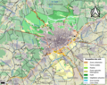
 Localisation de Nîmes Métropole.png 4,167 × 3,654; 1,001 KB
-
 Map commune FR insee code 30189.png 756 × 605; 169 KB
-
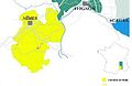
 Map Nîmes Métropole.png 838 × 590; 685 KB
-
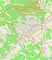 Map Nîmes.jpg 1,859 × 2,146; 2.51 MB
-
 Map of Nîmes.jpg 1,410 × 867; 351 KB
-
 Nimes dot.png 1,804 × 1,689; 164 KB


