Category:Maps of Mount Everest
Jump to navigation
Jump to search
Wikimedia category | |||||
| Upload media | |||||
| Instance of | |||||
|---|---|---|---|---|---|
| Category combines topics | |||||
| Mount Everest | |||||
Earth's highest mountain above sea level, located in the Mahalangur Himal sub-range of the Himalayas         | |||||
| Pronunciation audio | |||||
| Instance of | |||||
| Part of |
| ||||
| Named after |
| ||||
| Made from material | |||||
| Located in protected area | |||||
| Location |
| ||||
| Has part(s) |
| ||||
| Significant event |
| ||||
| Mountain range | |||||
| Topographic prominence |
| ||||
| Topographic isolation |
| ||||
| Highest point | |||||
| Elevation above sea level |
| ||||
| Visitors per year |
| ||||
| Different from | |||||
 | |||||
Media in category "Maps of Mount Everest"
The following 42 files are in this category, out of 42 total.
-
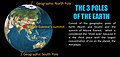 3poles.jpg 1,512 × 720; 119 KB
-
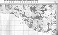 CH-NP 79-80 Bdy Map50.jpg 3,216 × 1,964; 1.11 MB
-
 Everest 1858.jpg 1,500 × 1,046; 228 KB
-
 Everest reconnaissance expedition, 1921.svg 1,000 × 658; 1.72 MB
-
 Everest view from Sat.-az.jpg 540 × 540; 104 KB
-
 Everest view from Sat.JPG 540 × 540; 71 KB
-
 Everest, northern approaches.svg 679 × 555; 174 KB
-
 Geology of Everest region, 1921.jpg 6,084 × 3,888; 5.51 MB
-
 Karte Mount Everest - Route Hillary und Norgay.png 1,000 × 931; 873 KB
-
 Karte Mount Everest.png 1,000 × 1,000; 1.1 MB
-
 Kathmandu to Mount Everest approach march, Bonington 1975.svg 4,666 × 2,115; 6.63 MB
-
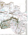
 Kharta from 1921 map.jpg 1,257 × 961; 196 KB
-
 Lage des Mount Everest.PNG 500 × 599; 144 KB
-

-
 Map India and Pakistan 1-250,000 Tile NG 45-2 Mount Everest.jpg 5,000 × 3,831; 5.91 MB
-
 Map of Kharta region, east of Mount Everest.svg 1,279 × 1,194; 464 KB
-
-
 Mount Everest - Hillary and Norgay route - map-fr.svg 1,000 × 735; 1.03 MB
-
 Mount Everest approach march, Bonington 1975.svg 1,106 × 1,403; 1.18 MB
-
 Mount Everest Climbing Routes 1924-1996 photomap-fr.svg 1,208 × 900; 1.11 MB
-
 Mount Everest location in Himalaya map-Ar.png 2,000 × 1,151; 3.91 MB
-
 Mount Everest location in Himalaya map-fr.svg 1,190 × 685; 1.33 MB
-
 Mount Everest location in Himalaya map-hu.svg 1,190 × 685; 1.31 MB
-
 Mount Everest location in Himalaya map-mk.svg 1,190 × 685; 1.35 MB
-
 Mount Everest location in Himalaya map-ru.svg 1,190 × 685; 1.31 MB
-
 Mount Everest location in Himalaya map-uk.svg 1,190 × 685; 1.3 MB
-
 Mount Everest region map-fr.svg 1,733 × 1,334; 1.04 MB
-
 Mount Everest tourists flow map 1980-2000 -fr.svg 1,250 × 1,750; 2.47 MB
-
 Mount Everest tourists flow map 1980-2000 -heb.svg 1,250 × 1,750; 2.68 MB
-
 MountEverestRelief.png 1,280 × 620; 1.82 MB
-
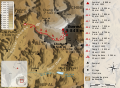
 Mt Everest 1977 RU.jpg 5,202 × 2,485; 7.68 MB
-
 Nepal topo en-SNP.jpg 228 × 150; 10 KB
-
 Preliminary map of Mount Everest Expedition, 1921. Map I (cropped).jpg 1,367 × 1,199; 360 KB
-
 Preliminary map of Mount Everest Expedition, 1921. Map I.jpg 6,284 × 3,900; 2.22 MB
-
 Preliminary Map of Mount Everest. Howard-Bury, 1922.jpg 5,464 × 4,388; 2.6 MB
-
 Routes near Mount Everest, 1950 and 1951.svg 1,080 × 810; 177 KB
-
 Routes near Mount Everest, 1950.svg 1,080 × 810; 169 KB
-
 Routes near Mount Everest, 1951.svg 1,080 × 810; 175 KB
-
 STS058-101-12 2.JPG 540 × 540; 94 KB
-
 Trek routes to Everest, 1950 and 1951.svg 744 × 1,052; 95 KB
-
 Trek routes to Everest, 1950.svg 744 × 1,052; 91 KB
-
 Trek routes to Everest, 1951.svg 744 × 1,052; 92 KB


.jpg)


.jpg)


.jpg)


