Category:Maps of Mobile, Alabama
Jump to navigation
Jump to search
Wikimedia category | |||||
| Upload media | |||||
| Instance of | |||||
|---|---|---|---|---|---|
| Category combines topics | |||||
| Mobile | |||||
county seat of Mobile County, Alabama, United States     | |||||
| Instance of | |||||
| Part of |
| ||||
| Named after | |||||
| Location | Mobile County, Alabama | ||||
| Located in or next to body of water | |||||
| Head of government |
| ||||
| Inception |
| ||||
| Significant event |
| ||||
| Population |
| ||||
| Area |
| ||||
| Elevation above sea level |
| ||||
| Different from | |||||
| official website | |||||
 | |||||
Subcategories
This category has only the following subcategory.
O
Media in category "Maps of Mobile, Alabama"
The following 21 files are in this category, out of 21 total.
-
 1861 Mobile detail of H.H. Lloyd & Co's Military Charts USA by Viele BPL 14829.png 736 × 1,062; 1.16 MB
-
 1919 map Mobile, Alabama Automobile Blue Book,.jpg 908 × 727; 157 KB
-

-

-

-
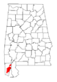
 Location Map USA Alabama Mobile.png 887 × 1,146; 669 KB
-
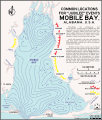
 Map Mobile River tunnels area.gif 680 × 560; 51 KB
-

-
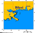 Map of Biloxi and Mississippi coast.png 514 × 482; 13 KB
-
 Mississippi Gulf Coast New Orleans to Mobile 1953 Map.jpg 6,733 × 4,746; 10.98 MB
-
 Mobile bay jubilee.svg 367 × 430; 2.98 MB
-

-
 Mobile in 1732.jpg 592 × 996; 612 KB
-
 Mobile US Census 20 miles.gif 575 × 425; 69 KB
-
 Mobile, Alabama Metropolitan Statistical Area.svg 558 × 887; 116 KB
-
 Mobile-Daphne-Fairhope, Alabama Combined Statistical Area.svg 558 × 887; 141 KB
-
 MobShade.gif 336 × 482; 6 KB
-
 Old Mobile Map 1702.jpg 664 × 514; 59 KB
-
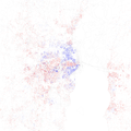 Race and ethnicity 2010- Mobile (5560434648).png 3,009 × 3,009; 2.02 MB
-
 Toulminville.jpg 300 × 420; 132 KB
-


.jpg)
.jpg)
.jpg)


.png)

.jpg)