Category:Maps of Miyagi prefecture
Jump to navigation
Jump to search
日本語: 宮城県の地図のカテゴリ。 日本全体における県の位置図は"Locator maps of ~"を、県内における各市町村の位置図は"Locator maps of municipalities ~"を、各郡の地図は"Maps of districts ~"を、過去の市町村の地図は"Maps of former municipalities ~"を参照。

Wikimedia category | |||||
| Upload media | |||||
| Instance of | |||||
|---|---|---|---|---|---|
| Category combines topics | |||||
| Miyagi Prefecture | |||||
prefecture of Japan      | |||||
| Pronunciation audio | |||||
| Instance of | |||||
| Named after |
| ||||
| Location | Japan | ||||
| Capital | |||||
| Legislative body |
| ||||
| Executive body |
| ||||
| Anthem |
| ||||
| Head of government |
| ||||
| Mascot |
| ||||
| Legal form |
| ||||
| Inception |
| ||||
| Highest point | |||||
| Population |
| ||||
| Area |
| ||||
| Replaces |
| ||||
| official website | |||||
 | |||||
Subcategories
This category has the following 7 subcategories, out of 7 total.
2
D
L
S
Pages in category "Maps of Miyagi prefecture"
This category contains only the following page.
Media in category "Maps of Miyagi prefecture"
The following 58 files are in this category, out of 58 total.
-
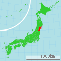
 Flag map of Miyagi Prefecture.svg 450 × 505; 6 KB
-
 2011 Tohoku tsunami flooded area Sendai Natori by GSI and Namiwake Shrine.jpg 1,075 × 760; 303 KB
-
 2011 Tohoku tsunami flooded area Sendai Natori by GSI and Yuriage Tamaura.jpg 1,075 × 760; 310 KB
-
 2011 Tohoku tsunami flooded area Sendai Natori by GSI.png 1,075 × 760; 800 KB
-
 Admiralty Chart No 3409 Ishinomaki Wan and Sakata Ko to Tsugaro Kaikyo, Published 1904.jpg 11,044 × 16,098; 67.02 MB
-
 Admiralty Chart No 806 Sendai Bay to Miyako Bay, Published 1885.jpg 11,189 × 16,346; 36.82 MB
-

-
 Growth rate map of municipalities of Miyagi prefecture, Japan.svg 600 × 752; 24 KB
-
 Hasama-Miyagi.png 253 × 222; 5 KB
-
 Hatamaki-war.png 1,005 × 733; 2.11 MB
-
 Higashimatsushima-city.png 253 × 222; 4 KB
-
 Ichihasama-Miyagi.png 253 × 222; 5 KB
-
 Iwadeyama-Miyagi.png 253 × 222; 4 KB
-
 Iwanuma-Miyagi.png 253 × 222; 4 KB
-
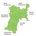
 Japan Miyagi Map Chikei.png 280 × 280; 32 KB
-
 Japan prov map mutsu.png 235 × 300; 6 KB
-
 Japan prov map mutsu701.png 250 × 320; 7 KB
-
 Japan prov map mutsu718.png 250 × 319; 7 KB
-
 Kahoku-Miyagi.png 253 × 222; 5 KB
-
 Kurihara-Miyagi.png 253 × 222; 4 KB
-
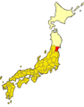
 Map of Japan with highlight on 04 Miyagi prefecture.svg 1,024 × 1,024; 15 KB
-
 Map of license plates in Miyagi Japan.svg 600 × 680; 27 KB
-
 Map of Miyagi Prefecture Ja.svg 484 × 538; 18 KB
-
 Matsuyama-Miyagi.png 253 × 222; 4 KB
-
 Miyagi Igu-gun.png 253 × 222; 11 KB
-
 Miyagi Katta-gun.png 253 × 222; 11 KB
-
 Miyagi Kurihara-gun.png 253 × 222; 11 KB
-
 Miyagi Kurokawa-gun.png 253 × 222; 11 KB
-
 Miyagi map.png 903 × 1,023; 146 KB
-
 Miyagi Miyagi-gun.png 253 × 222; 11 KB
-
 Miyagi Monou-gun.png 253 × 222; 10 KB
-
 Miyagi Motoyoshi-gun.png 253 × 222; 10 KB
-
 Miyagi Shibata-gun.png 253 × 222; 11 KB
-
 Miyagi Shida-gun.png 253 × 222; 10 KB
-
 Miyagi Tamatsukuri-gun.png 253 × 222; 10 KB
-
 Miyagi Toda-gun.png 253 × 222; 11 KB
-
 Miyagi Tome-gun.png 253 × 222; 10 KB
-
 Miyagi Watari-gun.png 253 × 222; 10 KB
-
 Miyagi-geo-stub.png 675 × 758; 48 KB
-
 Miyagi-ken géolocalisation relief.svg 1,703 × 2,049; 3.21 MB
-
 Miyagi-ken géolocalisation.svg 1,703 × 2,049; 2.9 MB
-
 Miyagi-map.png 1,500 × 1,620; 857 KB
-
 Miyagi-pref.png 253 × 222; 4 KB
-
 Miyagi3-map.png 2,500 × 2,791; 1.75 MB
-
 MiyagiMapCurrent.png 901 × 901; 40 KB
-
 MiyagiMapCurrentHe.png 901 × 901; 27 KB
-
 Onagawa-Miyagi.png 300 × 345; 5 KB
-
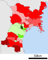
 Sendai Metropolitan Employment Area.svg 401 × 401; 59 KB
-
 Shadow picture of Miyagi prefecture.png 344 × 400; 3 KB
-
 Shiroishi-city.png 253 × 222; 4 KB
-
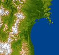 The topography surrounding Sendai.jpg 6,330 × 5,879; 4.69 MB
-
 地図 ナンバープレート 04000.svg 484 × 538; 12 KB
-
 地図 市郡界 1950 04000.svg 484 × 538; 19 KB
-
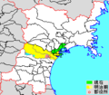
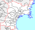
 地図 衆議院小選挙区 04 00.svg 484 × 538; 11 KB
-
 宮城県地域区分図.svg 600 × 752; 16 KB
-
 自治体区画図 1975 04000.svg 484 × 538; 13 KB
-
 色麻競馬場昭和初期.jpg 528 × 310; 114 KB
-
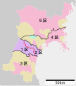 衆議院小選挙区 宮城県.svg 484 × 538; 30 KB


