Category:Maps of Miki-city
Jump to navigation
Jump to search
日本語: 三木市に関する地図のカテゴリ
Media in category "Maps of Miki-city"
The following 11 files are in this category, out of 11 total.
-
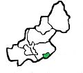
 Besshotown Mikicity Hyogopref range.JPG 579 × 512; 56 KB
-
 Hosokawatown Mikicity Hyogopref range.JPG 579 × 512; 57 KB
-
 Kuciyokawatown Mikicity Hyogopref range.JPG 579 × 512; 56 KB
-
 Kurumi Mikicity Hyogopref range.JPG 579 × 512; 57 KB
-
 Midorigaokatown Mikicity Hyogopref range.JPG 579 × 512; 56 KB
-
 Miki in Hyogo Prefecture Ja.svg 520 × 770; 36 KB
-
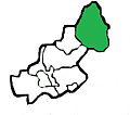
 Miki Mikicity Hyogopref range.JPG 579 × 512; 56 KB
-
 MikiCity Hyogopref district list.JPG 579 × 512; 67 KB
-

-
 Shijimitown Mikicity Hyogopref range.JPG 579 × 512; 56 KB
-
 Yokawatown Mikicity Hyogopref range.JPG 579 × 512; 56 KB


