Category:Maps of Marble Hill, Manhattan
Jump to navigation
Jump to search
Media in category "Maps of Marble Hill, Manhattan"
The following 23 files are in this category, out of 23 total.
-

-

-

-

-
 (New York Island. Military; unfinished. LOC gm71002309.jpg 3,341 × 5,066; 1.89 MB
-

-
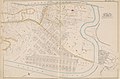
 Bromley Manhattan and Bronx Plate 33 publ. 1879.jpg 8,915 × 5,772; 14.13 MB
-
 Bromley Manhattan complete Plate 191 publ. 1921–23.jpg 8,437 × 5,825; 44.24 MB
-
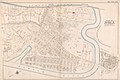
 Bromley Manhattan Plate 191 publ. 1916.jpg 5,483 × 3,887; 5.24 MB
-
 Bromley Manhattan Plate 191 publ. 1925.jpg 8,529 × 6,054; 11.43 MB
-
 Bromley Manhattan Plate 191 publ. 1927.jpg 8,331 × 5,768; 12.28 MB
-
 Bromley Manhattan Plate 45 publ. 1891.jpg 6,424 × 4,255; 5.97 MB
-
 Bromley Manhattan Plate 45 publ. 1897.jpg 5,908 × 3,929; 6.94 MB
-
 Bromley Manhattan Plate 49 publ. 1911.jpg 5,798 × 3,881; 6.28 MB
-
 Bronx topographical Sheet 05 publ. 1873.jpg 5,640 × 4,926; 7.84 MB
-
-
 Hyde V. 2 Plate 43 publ. 1901.jpg 7,230 × 5,428; 5.7 MB
-
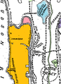
 Marble hill manhattan map.png 320 × 302; 6 KB
-
 New York City - Manhattan - Marble Hill.PNG 1,326 × 1,291; 86 KB
-

-
 Sanborn Fire Insurance Map from New York, Bronx, Manhattan, New York. LOC sanborn06116 013-2.tif 5,484 × 7,913; 124.15 MB
-
 Section 21 of Final Maps and Profiles, of the 23rd & 24th Wards.jpg 7,230 × 4,638; 5.45 MB
-
 Spuyten Duyvil IRT map.jpg 200 × 272; 10 KB


_-_re-tinted_Marble_Hill_detail.png)