Category:Maps of Manyara Region
Jump to navigation
Jump to search
Media in category "Maps of Manyara Region"
The following 22 files are in this category, out of 22 total.
-
 Babati District in Manyara 2022.svg 785 × 640; 475 KB
-
 Babati Town in Manyara 2022.svg 785 × 640; 475 KB
-
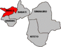
 Babati.png 280 × 217; 6 KB
-
 Hanang District in Manyara 2022.svg 785 × 640; 475 KB
-
 Hanang.GIF 280 × 217; 5 KB
-
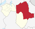
 Kiteto District in Manyara 2022.svg 785 × 640; 475 KB
-
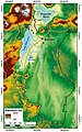 Manyara basin.jpg 394 × 629; 91 KB
-
 Manyara-Kiteto.svg 744 × 524; 358 KB
-
 Mbulu District in Manyara 2022.svg 785 × 640; 475 KB
-
 Mbulu Town in Manyara 2022.svg 785 × 640; 475 KB
-
 Mbulu.GIF 280 × 217; 5 KB
-
 Simanjiro District in Manyara 2022.svg 785 × 640; 475 KB
-
 Simanjiro.GIF 280 × 217; 5 KB
-
 Tanzania Babati location map.svg 135 × 120; 1.46 MB
-
 Tanzania Hanang location map.svg 135 × 120; 1.46 MB
-
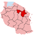
 Tanzania Kiteto location map.svg 135 × 120; 1.46 MB
-
 Tanzania Manyara location map.svg 3,302 × 3,143; 1.04 MB
-
 Tanzania Manyara location map2.svg 135 × 120; 1.46 MB
-
 Tanzania Manyara.png 536 × 546; 10 KB
-
 Tanzania Mbulu location map.svg 135 × 120; 1.46 MB
-
 Tanzania Simanjiro location map.svg 135 × 120; 1.46 MB
-
 TZ Manyara wilaya.gif 280 × 217; 5 KB


