Category:Maps of Magnières
Jump to navigation
Jump to search
Wikimedia category | |||||
| Upload media | |||||
| Instance of | |||||
|---|---|---|---|---|---|
| Category combines topics | |||||
| Magnières | |||||
commune in Meurthe-et-Moselle, France  Центр коммуны.    | |||||
| Instance of | |||||
| Location |
| ||||
| Street address |
| ||||
| Population |
| ||||
| Area |
| ||||
| official website | |||||
 | |||||
Media in category "Maps of Magnières"
The following 2 files are in this category, out of 2 total.
-
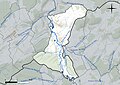 54331-Magnières-Hydro.jpeg 5,846 × 4,133; 1.92 MB
-
 54331-Magnières-Routes-Hydro.png 3,507 × 2,480; 2.09 MB

