Category:Maps of Lofoten
Jump to navigation
Jump to search
Wikimedia category | |||||
| Upload media | |||||
| Instance of | |||||
|---|---|---|---|---|---|
| Category combines topics | |||||
| Lofoten | |||||
archipelago and traditional district in Nordland county, Norway  | |||||
| Instance of |
| ||||
| Location | Nordland, Norway | ||||
| Located in or next to body of water | |||||
| Has part(s) | |||||
| Heritage designation |
| ||||
| Highest point | |||||
| Area |
| ||||
| Elevation above sea level |
| ||||
| Different from | |||||
| official website | |||||
 | |||||
Subcategories
This category has the following 6 subcategories, out of 6 total.
F
- Maps of Flakstad (3 F)
M
- Maps of Moskenes (3 F)
R
V
- Maps of Vestvågøy (10 F)
- Maps of Vågan (6 F)
Media in category "Maps of Lofoten"
The following 24 files are in this category, out of 24 total.
-
 FMIB 36905 Gouffre de Malstrom.jpeg 852 × 809; 129 KB
-
 Landgeneralkart 14, Lofoten, 1960.jpg 6,516 × 6,566; 6.75 MB
-
 Lofoten and Vesteraalen geology.png 1,864 × 2,071; 595 KB
-
 Maelstrom, Carta Marina.png 1,052 × 714; 1.45 MB
-
 Map-of-Lofoten-and-Vesteraalen-mk.svg 463 × 500; 748 KB
-
 Map-of-Lofoten-and-Vesteraalen.svg 463 × 500; 747 KB
-
 Norlandiakartet blad 2 (12066489195).jpg 4,700 × 3,447; 18.14 MB
-
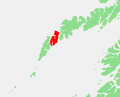
 Norway - Austvagoy.PNG 570 × 460; 13 KB
-
 Norway - Flakstadoy.PNG 570 × 460; 13 KB
-
 Norway - Gimsoy.PNG 570 × 460; 13 KB
-
 Norway - Gimsøya.png 713 × 415; 14 KB
-
 Norway - Litlmolla.png 570 × 460; 13 KB
-
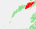
 Norway - Lofoten detail.PNG 570 × 460; 13 KB
-
 Norway - Lofoten.PNG 570 × 491; 17 KB
-
 Norway - Mosken.png 713 × 415; 14 KB
-
 Norway - Moskenesoy.PNG 570 × 460; 7 KB
-
 Norway - Rost.PNG 570 × 460; 13 KB
-
 Norway - Skrova.png 713 × 415; 14 KB
-
 Norway - Store Molla.PNG 570 × 460; 13 KB
-
 Norway - Vaeroy.PNG 570 × 460; 13 KB
-
 Norway - Vestvagoy.PNG 570 × 460; 13 KB
-
 Norway - Årsteinen.png 713 × 415; 14 KB
-
 Sjøkart over strekningen mellom Lofotodden og Ure fra 1905 (2).png 4,616 × 2,662; 35.16 MB
-
 Sjøkart over strekningen mellom Lofotodden og Ure fra 1905.png 4,679 × 2,623; 35.12 MB


.jpg)


.png)
