Category:Maps of Limpopo municipalities with 2006 borders
Jump to navigation
Jump to search
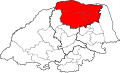
This category contains maps of municipalities in the Limpopo province of South Africa that show the the municipal borders as they were after the municipal election of 1 March 2006. The borders of many municipalities changed again in 2011.
Media in category "Maps of Limpopo municipalities with 2006 borders"
The following 75 files are in this category, out of 75 total.
-
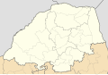 Blank map of Limpopo (2006).svg 850 × 588; 561 KB
-
 DC33 locator.svg 1,000 × 602; 170 KB
-
 DC34 locator.svg 1,000 × 602; 170 KB
-
 DC35 locator.svg 1,000 × 602; 170 KB
-
 DC36 locator.svg 1,000 × 602; 170 KB
-
 DC47 locator.svg 1,000 × 602; 170 KB
-
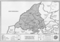
 Map No. 33 of Schedule 2 to Notice 1998 of 2005.png 2,800 × 1,950; 4 MB
-
 Map No. 34 of Schedule 2 to Notice 1998 of 2005.png 2,800 × 1,950; 3.84 MB
-
 Map No. 35 of Schedule 2 to Notice 1998 of 2005.png 2,800 × 1,950; 3.74 MB
-
 Map No. 36 of Schedule 2 to Notice 1998 of 2005.png 2,800 × 1,950; 3.87 MB
-
 Map No. 37 of Schedule 2 to Notice 1998 of 2005.png 3,000 × 2,100; 4.05 MB
-
 Map of Limpopo with Aganang highlighted (2006).svg 925 × 621; 332 KB
-
 Map of Limpopo with Ba-Phalaborwa highlighted (2006).svg 925 × 621; 338 KB
-
 Map of Limpopo with Bela-Bela highlighted (2006).svg 925 × 621; 336 KB
-
 Map of Limpopo with Blouberg highlighted (2006).svg 925 × 621; 340 KB
-
 Map of Limpopo with Capricorn highlighted (2006).svg 925 × 621; 351 KB
-
 Map of Limpopo with Elias Motsoaledi highlighted (2006).svg 925 × 621; 336 KB
-
 Map of Limpopo with Ephraim Mogale highlighted (2006).svg 925 × 621; 336 KB
-
 Map of Limpopo with Fetakgomo highlighted (2006).svg 925 × 621; 335 KB
-
 Map of Limpopo with Greater Giyani highlighted (2006).svg 925 × 621; 339 KB
-
 Map of Limpopo with Greater Letaba highlighted (2006).svg 925 × 621; 333 KB
-
 Map of Limpopo with Greater Tubatse highlighted (2006).svg 925 × 621; 335 KB
-
 Map of Limpopo with Greater Tzaneen highlighted (2006).svg 925 × 621; 336 KB
-
 Map of Limpopo with Lepelle-Nkumpi highlighted (2006).svg 925 × 621; 339 KB
-
 Map of Limpopo with Lephalale highlighted (2006).svg 925 × 621; 369 KB
-
 Map of Limpopo with Makhado highlighted (2006).svg 925 × 621; 340 KB
-
 Map of Limpopo with Makhuduthamaga highlighted (2006).svg 925 × 621; 336 KB
-
 Map of Limpopo with Maruleng highlighted (2006).svg 925 × 621; 337 KB
-
 Map of Limpopo with Modimolle highlighted (2006).svg 925 × 621; 337 KB
-
 Map of Limpopo with Mogalakwena highlighted (2006).svg 925 × 621; 339 KB
-
 Map of Limpopo with Molemole highlighted (2006).svg 925 × 621; 334 KB
-
 Map of Limpopo with Mookgophong highlighted (2006).svg 925 × 621; 333 KB
-
 Map of Limpopo with Mopani highlighted (2006).svg 925 × 621; 349 KB
-
 Map of Limpopo with municipalities blank (2006).svg 925 × 621; 810 KB
-
 Map of Limpopo with Musina highlighted (2006).svg 925 × 621; 347 KB
-
 Map of Limpopo with Mutale highlighted (2006).svg 925 × 621; 337 KB
-
 Map of Limpopo with Polokwane highlighted (2006).svg 925 × 621; 334 KB
-
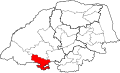
 Map of Limpopo with Sekhukhune highlighted (2006).svg 925 × 621; 344 KB
-
 Map of Limpopo with Thabazimbi highlighted (2006).svg 925 × 621; 343 KB
-
 Map of Limpopo with the Mopani DMA highlighted (2006).svg 925 × 621; 341 KB
-
 Map of Limpopo with Thulamela highlighted (2006).svg 925 × 621; 339 KB
-
 Map of Limpopo with Vhembe highlighted (2006).svg 925 × 621; 351 KB
-
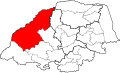
 Map of Limpopo with Waterberg highlighted (2006).svg 925 × 621; 378 KB
-
 NP03a2 locator.svg 1,000 × 602; 170 KB
-
 NP03a3 locator.svg 1,000 × 602; 170 KB
-
 NP03a4 locator.svg 1,000 × 602; 170 KB
-
 NP03a5 locator.svg 1,000 × 602; 170 KB
-
 NP03a6 locator.svg 1,000 × 602; 170 KB
-
 NP331 locator.svg 1,000 × 602; 170 KB
-
 NP332 locator.svg 1,000 × 602; 170 KB
-
 NP333 locator.svg 1,000 × 602; 170 KB
-
 NP334 locator.svg 1,000 × 602; 170 KB
-
 NP335 locator.svg 1,000 × 602; 170 KB
-
 NP341 locator.svg 1,000 × 602; 170 KB
-
 NP342 locator.svg 1,000 × 602; 170 KB
-
 NP343 locator.svg 1,000 × 602; 170 KB
-
 NP344 locator.svg 1,000 × 602; 170 KB
-
 NP351 locator.svg 1,000 × 602; 170 KB
-
 NP352 locator.svg 1,000 × 602; 170 KB
-
 NP353 locator.svg 1,000 × 602; 170 KB
-
 NP354 locator.svg 1,000 × 602; 170 KB
-
 NP355 locator.svg 1,000 × 602; 170 KB
-
 NP361 locator.svg 1,000 × 602; 170 KB
-
 NP362 locator.svg 1,000 × 602; 170 KB
-
 NP364 locator.svg 1,000 × 602; 170 KB
-
 NP365 locator.svg 1,000 × 602; 170 KB
-
 NP366 locator.svg 1,000 × 602; 170 KB
-
 NP367 locator.svg 1,000 × 602; 170 KB
-
 NPDMA33 locator.svg 1,000 × 602; 170 KB
-
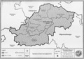
 South Africa Districts showing Capricorn.png 1,141 × 828; 31 KB
-
 South Africa Districts showing LP.png 1,141 × 828; 31 KB
-
 South Africa Districts showing Mopani.png 1,141 × 828; 31 KB
-
 South Africa Districts showing Sekhukhune.png 1,141 × 828; 31 KB
-
 South Africa Districts showing Vhembe.png 1,141 × 828; 31 KB
-
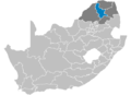
 South Africa Districts showing Waterberg.png 1,141 × 828; 31 KB


.svg)
.svg)
.svg)
.svg)
.svg)
.svg)
.svg)
.svg)
.svg)
.svg)
.svg)
.svg)
.svg)
.svg)
.svg)
.svg)
.svg)
.svg)
.svg)
.svg)
.svg)
.svg)
.svg)
.svg)
.svg)
.svg)
.svg)
.svg)
.svg)
.svg)
.svg)


.svg)
.svg)