Category:Maps of Landkreis Ravensburg
Jump to navigation
Jump to search
Wikimedia category | |||||
| Upload media | |||||
| Instance of | |||||
|---|---|---|---|---|---|
| Category combines topics | |||||
| Landkreis Ravensburg | |||||
district of Baden-Württemberg, Germany     | |||||
| Instance of |
| ||||
| Location | Tübingen Government Region, Baden-Württemberg, Germany | ||||
| Capital | |||||
| Head of government |
| ||||
| Population |
| ||||
| Area |
| ||||
| Elevation above sea level |
| ||||
| official website | |||||
 | |||||
Subcategories
This category has the following 3 subcategories, out of 3 total.
K
Media in category "Maps of Landkreis Ravensburg"
The following 50 files are in this category, out of 50 total.
-
 Altshausen Hartweiher Kataster.jpg 1,804 × 1,889; 621 KB
-
 Amt Schlier HStAS N 34 Nr. 67 Bild 2 (1-1417354-2).jpg 1,972 × 1,525; 1.79 MB
-
 Baden wuerttemberg rv.png 221 × 245; 13 KB
-
 Baindt Urkataster 1823.jpg 3,361 × 2,325; 4.01 MB
-
 BudS - Argenbühl Topo.jpg 8,960 × 9,770; 36.87 MB
-
 BudS - Bodnegg Topo.jpg 5,755 × 6,070; 13.24 MB
-
 BudS - Grünkraut Topo.jpg 5,130 × 6,140; 11.21 MB
-
 BudS - Gullen Topo.jpg 8,320 × 10,600; 42.82 MB
-
 BudS - Isny Topo.jpg 8,770 × 10,150; 34.05 MB
-
 BudS - Kißlegg Topo.jpg 8,500 × 9,100; 29.11 MB
-
 BudS - Leutkirch Topo.jpg 7,970 × 7,600; 28.82 MB
-
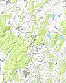
 BudS - LK Ravensburg Topo.jpg 10,300 × 8,400; 50.9 MB
-
 BudS - Schlier Topo.jpg 7,550 × 8,600; 21.83 MB
-
 BudS - Vogt Topo.jpg 6,590 × 7,530; 17.12 MB
-
 BudS - Waldburg Topo.jpg 6,370 × 7,660; 16.21 MB
-
 BudS - Wolfegg Topo.jpg 7,900 × 9,890; 24.33 MB
-
 Gemeinde Grünkraut.jpg 868 × 1,231; 367 KB
-
 Gemeindegebiet Grünkraut.png 868 × 1,231; 449 KB
-
 Gemeindeverwaltungsverband Altshausen.png 949 × 744; 172 KB
-
 Gemeindeverwaltungsverband Fronreute-Wolpertswende.png 949 × 744; 168 KB
-
 Gemeindeverwaltungsverband Gullen.png 949 × 744; 160 KB
-
 Gemeindeverwaltungsverband Mittleres Schussental.png 949 × 744; 177 KB
-
 Grundriss des unmittelbaren Reichsstift und Gotteshauses Weingarten HStAS N 34 Nr 77.jpg 1,499 × 2,201; 1.71 MB
-
 HkDE-wt Leutkirch 1800.svg 850 × 1,594; 87 KB
-
 HkDE-wt Ravensburg 1800.svg 1,240 × 1,134; 244 KB
-
 HkDE-wt Waldsee 1800.svg 1,311 × 1,453; 137 KB
-
 HkDE-wt Wangen 1800.svg 1,240 × 1,063; 94 KB
-
 Karte des Zehntamts herwert der Schussen HStAS N 34 Nr 64.jpg 2,195 × 1,525; 1.49 MB
-
 Karte des Zehntamts über der Schussen HStAS N 34 Nr 66.jpg 2,106 × 1,512; 1.73 MB
-
 Lage des Landkreises Ravensburg in Deutschland.png 197 × 235; 4 KB
-
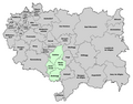
 Lage Landkreis Ravensburg in BW.svg 1,000 × 1,179; 116 KB
-
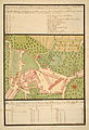
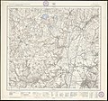
 Landkarte 168 Weingarten 1914.jpg 2,362 × 2,358; 2.53 MB
-
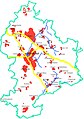
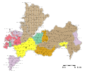
 Landkreis Ravensburg Karte mit Ortsnamen.png 949 × 744; 165 KB
-
 Landtafel wolfegg.jpg 2,891 × 3,803; 3.58 MB
-
 Locator map RV in Baden-Württemberg.svg 1,058 × 1,161; 278 KB
-
 Locator map RV in Germany.svg 1,075 × 1,273; 578 KB
-
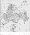
 Oberamt Leutkirch Karte.jpg 5,510 × 6,880; 2.86 MB
-
 Oberamt Ravensburg Karte.jpg 6,557 × 7,272; 6.3 MB
-
 Oberamt Waldsee Karte.jpg 4,263 × 4,903; 3.68 MB
-
 Oberamt Wangen Karte Teil 1.jpg 6,978 × 4,100; 5.34 MB
-
 Oberamt Wangen Karte Teil 2.jpg 7,002 × 3,993; 4.12 MB
-
 Oberamt Wangen Karte.jpg 7,000 × 8,100; 4.38 MB
-
 Ravensburg 1908.jpg 2,362 × 2,309; 2.97 MB
-
 RV in Baden-Württemberg.svg 753 × 868; 159 KB
-
 Schlier Wanderkarte am Rößlerweiher.jpg 4,288 × 2,848; 6.16 MB
-

-
 Territorii Lindaviensis Pars Septentrionalis.jpg 3,088 × 3,599; 926 KB
-
 Waldburg-Zeil und Trauchburg Karte 1725.jpg 2,767 × 3,641; 2.84 MB
-
 Wurzacher-Ried Wuerm-Zeit Endmoraenen-Stausee.jpg 1,200 × 1,200; 885 KB
-
 Württemberg 168 Weingarten 1914.jpg 4,401 × 4,113; 12.89 MB

.jpg)


_Landesarchiv_BW_EL_68_VI_Nr_13989_Bild_1_(2-5325309-1).png)


