Category:Maps of Krabi Province
Jump to navigation
Jump to search
Provinces of Thailand: Phra Nakhon Si Ayutthaya ·
Wikimedia category | |||||
| Upload media | |||||
| Instance of | |||||
|---|---|---|---|---|---|
| Category combines topics | |||||
| Krabi | |||||
province in southern Thailand     | |||||
| Instance of | |||||
| Location | Thailand | ||||
| Capital | |||||
| Population |
| ||||
| Area |
| ||||
| Different from | |||||
| official website | |||||
 | |||||
Subcategories
This category has the following 2 subcategories, out of 2 total.
E
M
- Maps of Phi Phi islands (5 F)
Media in category "Maps of Krabi Province"
The following 32 files are in this category, out of 32 total.
-
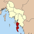
 Amphoe 8101.png 405 × 405; 19 KB
-
 Amphoe 8101.svg 1,596 × 2,605; 209 KB
-
 Amphoe 8102.png 405 × 405; 19 KB
-
 Amphoe 8102.svg 1,596 × 2,605; 212 KB
-
 Amphoe 8103.png 405 × 405; 18 KB
-
 Amphoe 8103.svg 1,596 × 2,605; 204 KB
-
 Amphoe 8104.png 405 × 405; 19 KB
-
 Amphoe 8104.svg 1,596 × 2,605; 212 KB
-
 Amphoe 8105.png 405 × 405; 19 KB
-
 Amphoe 8105.svg 1,596 × 2,605; 210 KB
-
 Amphoe 8106.png 405 × 405; 19 KB
-
 Amphoe 8106.svg 1,596 × 2,605; 207 KB
-
 Amphoe 8107.png 405 × 405; 19 KB
-
 Amphoe 8107.svg 1,596 × 2,605; 203 KB
-
 Amphoe 8108.png 405 × 405; 19 KB
-
 Amphoe 8108.svg 1,596 × 2,605; 211 KB
-
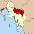
 Amphoe Krabi.png 405 × 405; 21 KB
-
 Amphoe Krabi.svg 1,596 × 2,605; 211 KB
-
 Anyavee Railay Bay Map.jpg 600 × 368; 100 KB
-
 Krabi PESA.svg 1,596 × 2,605; 199 KB
-
 Schematic map of turistic interesting places in Krabi provice, Thailand 2018.jpg 4,000 × 1,922; 4.31 MB
-
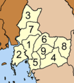
 Tambon 8101.png 350 × 545; 25 KB
-
 Tambon 8102.png 400 × 350; 17 KB
-
 Tambon 8103.png 400 × 550; 24 KB
-
 Tambon 8104.png 320 × 520; 28 KB
-
 Tambon 8105.png 360 × 400; 19 KB
-
 Tambon 8106.png 350 × 370; 12 KB
-
 Tambon 8107.png 350 × 350; 13 KB
-
 Tambon 8108.png 350 × 500; 26 KB
-
 Thailand Krabi location map.svg 1,596 × 2,605; 199 KB
-
 Thailand Krabi locator map.svg 1,052 × 1,849; 1.24 MB
-
 Thailand Krabi.png 178 × 300; 14 KB


