Category:Maps of Kernen im Remstal
Jump to navigation
Jump to search
| NO WIKIDATA ID FOUND! Search for Maps of Kernen im Remstal on Wikidata | |
| Upload media |
Media in category "Maps of Kernen im Remstal"
The following 11 files are in this category, out of 11 total.
-
 Historische Flurkarte kernen.png 38,400 × 38,400; 78.81 MB
-
 Historische Flurkarte Rommelshausen.png 10,169 × 8,129; 4.34 MB
-
 Historische Flurkarte Stetten.png 9,309 × 11,006; 6.74 MB
-
 Kernen im Remstal im Rems-Murr-Kreis.png 1,000 × 965; 410 KB
-
 Kiesersche Forstkarte Nr. 245 Endersbach (Mit der Rems).jpg 1,024 × 753; 213 KB
-
 Kiesersche Forstkarte Nr. 252 Württemberg.jpg 1,024 × 748; 434 KB
-
 Kiesersche Forstkarte Nr. 253 Gegend um Strümpfelbach und Stetten II.jpg 1,024 × 770; 462 KB
-
 Kiesersche Forstkarte Nr. 253 Gegend um Strümpfelbach und Stetten.jpg 1,024 × 795; 390 KB
-
 Kiesersche Forstkarte Nr. 253 Stetten im Remstal.jpg 1,024 × 707; 295 KB
-
 Kiesersche Forstkarte Nr. 253 Strimpfelbach (Strümpfelbach).jpg 1,024 × 751; 353 KB
-
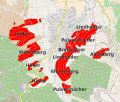 Weinlagen stetten i r.svg 1,130 × 959; 3.51 MB


.jpg)


.jpg)
