Category:Maps of Isfahan
Jump to navigation
Jump to search
Wikimedia category | |||||
| Upload media | |||||
| Instance of | |||||
|---|---|---|---|---|---|
| Category combines topics | |||||
| Category contains | |||||
| Isfahan | |||||
city in Isfahan Province, Iran  | |||||
| Instance of |
| ||||
| Location | Central District, Isfahan County, Isfahan Province, Iran | ||||
| Located in or next to body of water | |||||
| Legislative body |
| ||||
| Official language | |||||
| Head of government |
| ||||
| Significant event |
| ||||
| Population |
| ||||
| Area |
| ||||
| Elevation above sea level |
| ||||
| official website | |||||
 | |||||
Subcategories
This category has only the following subcategory.
P
Media in category "Maps of Isfahan"
The following 34 files are in this category, out of 34 total.
-

-
 Esfahan Map 1924.jpg 4,144 × 3,955; 4.92 MB
-
 Aghababaei Expressway map.png 1,460 × 1,580; 31 KB
-
 Ardestani Expressway map.png 1,460 × 1,580; 31 KB
-
 Chaharbagh Street map.png 1,460 × 1,580; 31 KB
-
 Chamran Expressway map-Isfahan.png 1,460 × 1,580; 40 KB
-
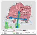
 Esfahan BRT map.png 1,460 × 1,580; 52 KB
-
 Esfahan scheme middle ages fr.png 776 × 1,241; 129 KB
-
 Esfahan scheme.svg 475 × 753; 56 KB
-
 General map of Isfahan by Pascal Coste.jpg 1,732 × 2,552; 414 KB
-
 Habibollahi Expressway map.png 1,460 × 1,580; 31 KB
-
 Hemmat Expressway map-Isfahan.png 1,460 × 1,580; 31 KB
-
 Hezar Jarib Boulevard Map.png 1,460 × 1,580; 31 KB
-
 Isfahan city location map.svg 779 × 832; 5.14 MB
-
 Isfahan city map.svg 2,963 × 2,787; 293 KB
-
 Isfahan County Map-blank.png 1,460 × 1,580; 39 KB
-
 Isfahan historical area map, 1940 vs 2010.jpg 2,261 × 3,863; 3.14 MB
-
 Isfahan iran 1942.jpg 1,320 × 863; 314 KB
-
 Isfahan mantaqeh.png 812 × 1,020; 45 KB
-
 Isfahan map district simple1.png 263 × 263; 7 KB
-
 Isfahan-charbagh.svg 760 × 720; 97 KB
-
 IsfahanBlank.PNG 1,460 × 1,580; 40 KB
-
 Kaveh Boulevard Map.png 1,460 × 1,580; 31 KB
-
 Keshvari Expressway map.png 1,460 × 1,580; 31 KB
-
 Kharrazi Expressway map.png 1,460 × 1,580; 31 KB
-
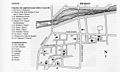 Map of New Julfa.jpg 900 × 540; 152 KB
-
 Meysami Expressway map.png 1,460 × 1,580; 30 KB
-
 Mirza Kouchak Khan Expressway map.png 1,460 × 1,580; 31 KB
-
 Plan safavidskog Isfahana.png 920 × 960; 243 KB
-
 Sayyad Expressway map-Isfahan.png 1,460 × 1,580; 31 KB
-
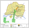 Schéma isfahan safavides.svg 744 × 713; 95 KB
-
 Shohadaye Soffeh Expressway map.png 1,460 × 1,580; 31 KB
-
 19th century map of isfahan.jpg 4,724 × 6,496; 9.07 MB
-
 Նոր Ջուղայի քարտեզ.jpg 777 × 776; 239 KB


