Category:Maps of Guarulhos
Jump to navigation
Jump to search
Wikimedia category | |||||
| Upload media | |||||
| Instance of | |||||
|---|---|---|---|---|---|
| Category combines topics | |||||
| Guarulhos | |||||
second largest city in the Brazilian state of São Paulo and a suburb of São Paulo city itself .JPG)    | |||||
| Instance of | |||||
| Location | São Paulo, Brazil | ||||
| Legislative body |
| ||||
| Head of government |
| ||||
| Inception |
| ||||
| Population |
| ||||
| Area |
| ||||
| Elevation above sea level |
| ||||
| Electorate |
| ||||
| official website | |||||
 | |||||
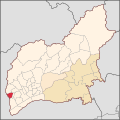
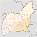
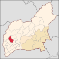
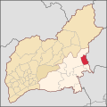
Media in category "Maps of Guarulhos"
The following 50 files are in this category, out of 50 total.
-
 BairroJardimVilaGalvao UPRVlGalvao DistritoSede MunicipioGuarulhos.svg 990 × 990; 718 KB
-
 BairroPicanço UPRVlGalvao DistritoSede MunicipioGuarulhos.svg 990 × 990; 718 KB
-
 BairroTorresTibagy UPRVilaGalvao DistritoSede MunicipioGuarulhos.svg 990 × 990; 718 KB
-
 BairroTranquilidade UPRVlGalvao DistritoSede MunicipioGuarulhos.svg 990 × 990; 718 KB
-
 BairroVilaRio UPRVlGalvao DistritoSede MunicipioGuarulhos.svg 990 × 990; 718 KB
-
 Jardimvilagalvao.png 842 × 934; 441 KB
-
 Mapa das bandeiras das Unidades de Planejamento Regional de Guarulhos - SP, Brasil.png 3,800 × 3,800; 3.3 MB
-
 Mapa do Bairro Centro, UPR Centro, Município de Guarulhos.svg 990 × 990; 718 KB
-

-

-

-

-

-
-

-

-

-

-

-

-
-

-

-

-

-

-

-

-

-

-

-

-

-

-

-

-

-

-

-

-

-

-

-

-

-

-

-

-
 Mapa numerado dos bairros administrativos de Guarulhos por distritos.svg 990 × 990; 653 KB
-
 SaoPaulo Municip Guarulhos.svg 1,024 × 691; 1.19 MB


