Category:Maps of Geary County, Kansas
Jump to navigation
Jump to search
Counties of Kansas: Allen · Anderson · Atchison · Barber · Barton · Bourbon · Brown · Butler · Chase · Chautauqua · Cherokee · Cheyenne · Clark · Clay · Cloud · Coffey · Comanche · Cowley · Crawford · Decatur · Dickinson · Doniphan · Douglas · Edwards · Elk · Ellis · Ellsworth · Finney · Ford · Franklin · Geary · Gove · Graham · Grant · Gray · Greeley · Greenwood · Hamilton · Harper · Harvey · Haskell · Hodgeman · Jackson · Jefferson · Jewell · Johnson · Kearny · Kingman · Kiowa · Labette · Lane · Leavenworth · Lincoln · Linn · Logan · Lyon · Marion · Marshall · McPherson · Meade · Miami · Mitchell · Montgomery · Morris · Morton · Nemaha · Neosho · Ness · Norton · Osage · Osborne · Ottawa · Pawnee · Phillips · Pottawatomie · Pratt · Rawlins · Reno · Republic · Rice · Riley · Rooks · Rush · Russell · Saline · Scott · Sedgwick · Seward · Shawnee · Sheridan · Sherman · Smith · Stafford · Stanton · Stevens · Sumner · Thomas · Trego · Wabaunsee · Wallace · Washington · Wichita · Wilson · Woodson · Wyandotte
Wikimedia category | |||||
| Upload media | |||||
| Instance of | |||||
|---|---|---|---|---|---|
| Category combines topics | |||||
| Geary County | |||||
county in Kansas, United States   | |||||
| Instance of | |||||
| Named after | |||||
| Location | Kansas | ||||
| Capital | |||||
| Inception |
| ||||
| Population |
| ||||
| Area |
| ||||
| official website | |||||
 | |||||
Subcategories
This category has only the following subcategory.
Media in category "Maps of Geary County, Kansas"
The following 27 files are in this category, out of 27 total.
-
 Detailed map of Junction City, Kansas.png 575 × 425; 37 KB
-
 Fort Riley and Pawnee Kansas.jpg 1,201 × 1,571; 598 KB
-

-

-

-

-
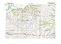
 Jefferson Township Geary County Kansas.jpg 1,697 × 2,958; 1.39 MB
-
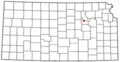
 Kansas Senate District 17 (2010).png 3,507 × 2,190; 316 KB
-
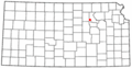
 Kansas Senate District 22 (2010).png 3,507 × 2,190; 315 KB
-
 Konza Prairie USGS Topo Map.jpg 5,536 × 4,075; 5.29 MB
-
 KSMap-doton-Fort Riley North.png 300 × 156; 8 KB
-
 KSMap-doton-Fort Riley-Camp Whiteside.png 300 × 156; 8 KB
-
 KSMap-doton-Grandview Plaza.png 300 × 156; 8 KB
-
 KSMap-doton-Junction City.png 300 × 156; 8 KB
-
 KSMap-doton-Milford.png 300 × 156; 8 KB
-
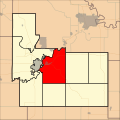
 Manhattan Micropolitan Area.png 567 × 308; 19 KB
-
 Map highlighting Blakely Township, Geary County, Kansas.svg 768 × 768; 63 KB
-
 Map highlighting Jackson Township, Geary County, Kansas.svg 768 × 768; 63 KB
-
 Map highlighting Jefferson Township, Geary County, Kansas.svg 768 × 768; 65 KB
-
 Map highlighting Liberty Township, Geary County, Kansas.svg 768 × 768; 63 KB
-
 Map highlighting Lyon Township, Geary County, Kansas.svg 768 × 768; 65 KB
-
 Map highlighting Milford Township, Geary County, Kansas.svg 768 × 768; 64 KB
-
 Map highlighting Smoky Hill Township, Geary County, Kansas.svg 768 × 768; 68 KB
-
 Map highlighting Wingfield Township, Geary County, Kansas.svg 768 × 768; 63 KB
-
 Map of Geary Co, Ks, USA.png 950 × 736; 415 KB
-
 Map of Jefferson Township, Geary County, Kansas. - NARA - 137929092.jpg 7,516 × 9,328; 4.35 MB
-
 Map of Kansas highlighting Geary County.svg 6,607 × 3,388; 24 KB


.png)
.png)


