Category:Maps of Fujian
Jump to navigation
Jump to search
- Provinces of the People's Republic of China
- Anhui
- Fujian
- Gansu
- Guangdong
- Guizhou
- Hainan
- Hebei
- Heilongjiang
- Henan
- Hubei
- Hunan
- Jiangsu
- Jiangxi
- Jilin
- Liaoning
- Qinghai
- Shaanxi
- Shandong
- Shanxi
- Sichuan
- Yunnan
- Zhejiang
- Autonomous regions
- Guangxi
- Inner Mongolia
- Ningxia
- Tibet Autonomous Region
- Xinjiang
- Special administrative regions
- Hong Kong
- Macau
Wikimedia category | |||||
| Upload media | |||||
| Instance of | |||||
|---|---|---|---|---|---|
| Category combines topics | |||||
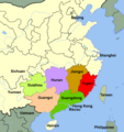
| Fujian | |||||
province of the People's Republic of China, covering the mountainous coast opposite Taiwan  someja satełitar noturna in setenbre .svg) | |||||
| Instance of | |||||
| Part of |
| ||||
| Location | PRC | ||||
| Capital | |||||
| Legislative body |
| ||||
| Executive body |
| ||||
| Head of government |
| ||||
| Party chief representative | |||||
| Highest point |
| ||||
| Population |
| ||||
| Area |
| ||||
| Replaces |
| ||||
| Different from | |||||
| official website | |||||
 | |||||
Subcategories
This category has the following 10 subcategories, out of 10 total.
Media in category "Maps of Fujian"
The following 40 files are in this category, out of 40 total.
-
 00SChina.png 369 × 391; 26 KB
-
 Administrative Division Fujian (PRC claimed).svg 1,000 × 1,080; 2.85 MB
-
 Admiralty Chart No 1754 Tung-Yin Shan to Wen-Chou Wan, Published 1960.jpg 16,328 × 11,123; 42.65 MB
-
 Admiralty Chart No 1786 Approaches to Ch'uan-Chou Chiang, Published 1956.jpg 11,221 × 8,267; 27.2 MB
-
 Admiralty Chart No 1968 Tai-Wan and Strait, Published 1966.jpg 16,365 × 11,235; 36.98 MB
-
 Admiralty Chart No 1985 Hai-T'an Hsia, Published 1959.jpg 11,068 × 16,307; 53.55 MB
-
 Changting.jpg 452 × 453; 22 KB
-
 DialekteFujians.jpeg 322 × 451; 40 KB
-
 Disputed Area between Zhejiang & Fujian Provinces of China.png 1,710 × 1,160; 321 KB
-
 Fujian outline map zh-hant.png 173 × 210; 14 KB
-
 Fujian outline map.png 173 × 210; 14 KB
-
 Fujian Shadow.png 98 × 129; 802 bytes
-
 Fujianfuan.jpg 400 × 431; 41 KB
-
 Guanqianzhen map.png 254 × 311; 51 KB
-
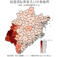 Hakkapopulationfujian.png 973 × 932; 122 KB
-
 Hockchew Tanka distribution.jpg 1,067 × 1,241; 150 KB
-
 Hok-ciu-ua De-du.jpg 587 × 715; 89 KB
-
 Hok-ciu-ua sai-eeung de-kuu.png 587 × 715; 66 KB
-
 Hokkien map.jpg 1,079 × 1,265; 127 KB
-
 Kongsi Hokkian.png 536 × 415; 30 KB
-
 Location of Kucheng.jpg 438 × 355; 60 KB
-
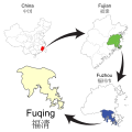 Locator map of Fuqing.svg 1,400 × 1,400; 1,008 KB
-
 LocMap of WH Wuyishan.png 280 × 210; 31 KB
-
 Main streets in the city of Guangze County,Fujian.PNG 881 × 540; 63 KB
-
 Map-of-the-Qiantang-River.jpg 3,593 × 2,608; 559 KB
-
 MeiZhou-Map-in-Hakka-Gan-Min-Yue.PNG 687 × 633; 33 KB
-
 MinFujian.png 325 × 368; 28 KB
-
 Nanpingkl.jpg 138 × 160; 6 KB
-
 Ningdekreise.png 470 × 610; 235 KB
-
 Qixing Islets.png 600 × 572; 20 KB
-
 She ethnic townships in Fujian.png 440 × 500; 44 KB
-
 SoutheastChina.png 1,680 × 1,677; 295 KB
-
 Subdivisions of Jinjiang-China.png 716 × 1,024; 87 KB
-
 Zhangzhoukl.jpg 134 × 160; 6 KB
-
 Zhongshanrd Map.png 800 × 300; 23 KB
-
 آثار مانوی در استان فوجیان چین.jpg 3,467 × 2,224; 499 KB
-
 福建省海峡西岸城际铁路网规划示意图.pdf 1,239 × 1,752; 1.63 MB
-
 福清市博物馆导览图.jpg 4,032 × 3,024; 2.26 MB
-
 福清市灵石山森林公园导览图.jpg 3,264 × 2,448; 1.58 MB
-
 福清永鸿野生动物世界地图.jpg 4,032 × 3,024; 2.75 MB

.svg)


