Category:Maps of Freital
Jump to navigation
Jump to search
Wikimedia category | |||||
| Upload media | |||||
| Instance of | |||||
|---|---|---|---|---|---|
| Category combines topics | |||||
| Freital | |||||
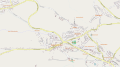
town in the district of Sächsische Schweiz-Osterzgebirge in the Free State of Saxony, Germany     | |||||
| Instance of |
| ||||
| Location | |||||
| Head of government |
| ||||
| Inception |
| ||||
| Population |
| ||||
| Area |
| ||||
| Elevation above sea level |
| ||||
| official website | |||||
 | |||||
Subcategories
This category has the following 2 subcategories, out of 2 total.
L
- Locator maps of Freital (60 F)
M
- Maps of Pesterwitz (8 F)
Media in category "Maps of Freital"
The following 35 files are in this category, out of 35 total.
-
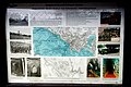 2015 Freital Bergbaulehrpfad Tafel am Tiefen Weißeritzstollen.jpg 2,723 × 1,816; 1.33 MB
-
 2019 Kleinnaundorf Wanderkarte Kleinnaundorfer Rundwanderweg.jpg 2,731 × 2,053; 2.71 MB
-
 2020 Freital Plakette Neumarkt zur Stadtgründung.jpg 3,079 × 2,069; 5.17 MB
-
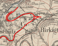 Birkigt.PNG 850 × 670; 1.07 MB
-
 Butterstraße.jpg 1,643 × 2,338; 1.27 MB
-
 Deubener Kohlebahn.png 938 × 1,032; 1.78 MB
-
 Die Siedlungen des Windberggebiets.jpg 3,401 × 2,610; 964 KB
-

-
-
-

-

-
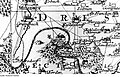
 Gemarkungen Burgk.png 1,735 × 1,083; 1.67 MB
-
 Geologische Karte Plauenscher Grund.jpg 1,440 × 492; 542 KB
-
 Gittersee.PNG 1,484 × 807; 2.7 MB
-
 Karte Albertsbahn.jpg 2,430 × 2,123; 1.31 MB
-
 Karte der Windbergbahn.png 1,505 × 2,040; 1.26 MB
-
 Kohlebahn Bannewitz.PNG 1,794 × 1,074; 4.55 MB
-
 Lange diercke sachsen gebiet des windbergs messtischblattdarstellung.jpg 1,177 × 781; 639 KB
-
 Lange diercke sachsen gebiet des windbergs reichskarte.jpg 1,164 × 592; 482 KB
-
 Lange diercke sachsen gebiet des windbergs schraffen.jpg 1,180 × 774; 612 KB
-
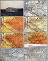 Lange diercke sachsen gebiet des windbergs.jpg 2,470 × 3,147; 6.86 MB
-
 Meilenblatt B 260 Tharandt.jpg 9,020 × 8,990; 28.08 MB
-
 Meilenblatt B 261 Freital.jpg 9,030 × 9,000; 27.79 MB
-
 Niederhermsdorfer Kohlezweigbahn.PNG 2,401 × 1,964; 11.43 MB
-
 NSG Windberg bei Freital (01).JPG 4,000 × 2,248; 3.96 MB
-
 Ortsplan Wurgwitz.svg 2,116 × 1,179; 3.01 MB
-
 Possendorf.PNG 2,779 × 1,914; 11.85 MB
-
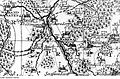
 Sachsen Große Kreisstädte Freital.PNG 970 × 755; 121 KB
-
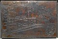
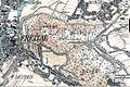
 Stadtplan Freital um 1930.jpg 1,043 × 1,053; 960 KB
-
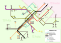 Stadtverkehr Freital.svg 980 × 692; 805 KB
-
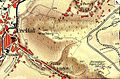
 Unteres Revier .png 1,351 × 603; 262 KB
-
 Windbergbahn.PNG 1,495 × 948; 3.63 MB
-

-
 Zeichnung Tiefer Elbstolln von Ernst Wilhelm Lindig 1831.jpg 4,134 × 2,478; 1.15 MB


.jpg)
.jpg)
.jpg)


.JPG)


_Lageplan_Zauckeroder_Kunstschacht.jpg)
