Category:Maps of Fes
Jump to navigation
Jump to search
Wikimedia category | |||||
| Upload media | |||||
| Instance of | |||||
|---|---|---|---|---|---|
| Category combines topics | |||||
| Fez | |||||
city in Morocco    | |||||
| Instance of | |||||
| Part of |
| ||||
| Location | Fez Prefecture, Fès-Meknès, Morocco | ||||
| Head of government |
| ||||
| Founded by | |||||
| Inception |
| ||||
| Significant event |
| ||||
| Population |
| ||||
| Area |
| ||||
| Elevation above sea level |
| ||||
| Different from | |||||
| official website | |||||
 | |||||
Media in category "Maps of Fes"
The following 29 files are in this category, out of 29 total.
-
 Fes Morocco-WFB-cs.jpg 300 × 321; 27 KB
-

-
 39 of 'Le Maroc Moderne, etc' (11178145686).jpg 2,240 × 1,330; 483 KB
-
 Carte de Fès-1917-a1.jpg 7,590 × 5,764; 11.67 MB
-
 Carte Enceintes de Fes - Alaouites.PNG 2,058 × 1,306; 107 KB
-
 Carte Enceintes de Fes.PNG 2,058 × 1,306; 103 KB
-
 Carte Fortifications de Fes - Fin de l'ere saadienne.png 2,058 × 1,306; 84 KB
-
 Carte Fortifications de Fes - Saadiens.PNG 2,058 × 1,306; 100 KB
-
 Dar al-makhzen plan.png 1,089 × 926; 99 KB
-
 ETH-BIB-Fès, Stadtplan 1928-Dia 247-10249.tif 2,971 × 3,512; 10.03 MB
-
 ETH-BIB-Plan von Fès, Detail (Medina)-Dia 247-02404.tif 3,396 × 2,815; 9.23 MB
-
 ETH-BIB-Plan von Fès, Übersicht-Dia 247-02403.tif 2,998 × 3,533; 10.2 MB
-
 ETH-BIB-Plan von Fès-Dia 247-02351-1.tif 3,455 × 2,809; 9.33 MB
-
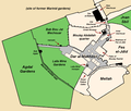
 Fes el Bali gates and neighbourhood names.png 1,299 × 894; 389 KB
-
 Fes el bali Talaa Kbira and Sghira map.png 943 × 491; 122 KB
-
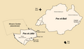
 Fes el-Jdid empty map.png 1,882 × 1,218; 242 KB
-
 Fes el-Jdid plan (version 2)-he.png 1,882 × 1,218; 345 KB
-
 Fes el-Jdid plan (version 2).png 967 × 830; 162 KB
-
 Fes el-Jdid plan.png 967 × 830; 155 KB
-
 Fes sous les Almohades.PNG 1,372 × 1,081; 52 KB
-
 Fes walls history 1 - early 11th century (pre-Almoravid).png 1,350 × 1,020; 43 KB
-
 Fes walls history 2 - early-mid 13th century (Almohad period).png 1,323 × 947; 40 KB
-
 Fes walls history 3 - late 14th or 15th century (Marinid period).png 2,150 × 1,250; 70 KB
-
 Fes walls history 4 - early 17th century (Saadian period).png 2,150 × 1,250; 83 KB
-
 Fes walls history 5 - circa 1913 (after Alaouite additions).png 2,150 × 1,250; 80 KB
-
 Fez overview map with listings.svg 544 × 544; 4.07 MB
-
 Gates of Fes.png 2,058 × 1,306; 89 KB
-
 Murailles de Fès - fin Xe siècle.PNG 1,350 × 1,020; 58 KB
-
 Plan Fes Merinides.PNG 2,058 × 1,306; 95 KB

.jpg)
.jpg)


-he.png)
.png)


.png)
.png)
.png)
.png)
.png)


