Category:Maps of East Asia
Jump to navigation
Jump to search
Subcategories
This category has the following 11 subcategories, out of 11 total.
Media in category "Maps of East Asia"
The following 133 files are in this category, out of 133 total.
-

-
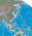
 1926 Pacific typhoon 1 track.png 2,700 × 1,669; 1.67 MB
-
 1926 Pacific typhoon 2 track.png 2,700 × 1,669; 3.11 MB
-
 1926 Pacific typhoon 3 track.png 2,700 × 1,669; 2.83 MB
-
 1926 Pacific typhoon 4 track.png 2,700 × 1,669; 3.2 MB
-
 1926 Pacific typhoon 5 track.png 2,700 × 1,669; 3.63 MB
-
 1930 Pacific typhoon 1 track.png 2,700 × 1,669; 1.21 MB
-
 1930 Pacific typhoon 2 track.png 2,700 × 1,669; 2.02 MB
-
 1930 Pacific typhoon 3 track.png 2,700 × 1,669; 2.67 MB
-
 1930 Pacific typhoon 4 track.png 2,700 × 1,669; 2.79 MB
-
 1930 Pacific typhoon 5 track.png 2,700 × 1,669; 3.92 MB
-
 1930 Pacific typhoon 6 track.png 2,700 × 1,812; 1.76 MB
-
 2013 Ivory Transportation (30885483595).jpg 4,258 × 2,940; 2.75 MB
-

-
 Admiralty Chart No 2459 North west Pacific Ocean, Published 1877.jpg 10,538 × 8,307; 8.76 MB
-
 Ajia tōbu yochizu (2676796880).jpg 2,000 × 1,367; 3.02 MB
-
 Amsterdam 1685 (1700) ca.png 1,772 × 1,250; 5.08 MB
-
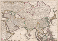
 Anthimos Gazis East Asia map Vienna 1802.jpg 1,760 × 1,566; 2.81 MB
-
 Asia ok.jpg 722 × 541; 38 KB
-
 AsiaOrientale.png 343 × 306; 9 KB
-
 Asie Orientale 1862.jpg 3,835 × 3,021; 2.07 MB
-

-

-
 Atlas Ortelius KB PPN369376781-086av-086br.jpg 3,000 × 2,194; 4.63 MB
-
 B26056088B - Tabvla Asiae VIII.jpg 6,276 × 4,807; 8.26 MB
-
 Bamboo Curtain.PNG 300 × 213; 6 KB
-
 Bamboo Curtain.svg 360 × 280; 317 KB
-
 CasparSchmalkalden AsiaMap.jpg 954 × 622; 234 KB
-
 China-Today oil reserves and demand-en.svg 1,500 × 1,093; 4.54 MB
-
 Chinese history frames - 51E146W, 14N52N-color topography, borders, coordinates.svg 3,188 × 1,275; 3.52 MB
-
 Chinese history large - 51E146W, 14N52N-color topography & borders.png 3,188 × 1,275; 4.79 MB
-
 Chinese history large - 51E146W, 14N52N-color topography.png 3,188 × 1,275; 4.74 MB
-
 Chinese history large - 51E146W, 14N52N-grey topography & borders.png 3,188 × 1,275; 2.34 MB
-
 Chinese history large - 51E146W, 14N52N-grey topography, borders, labels.png 3,188 × 1,275; 5.26 MB
-
 Chinese history large - 51E146W, 14N52N-grey topography.png 3,188 × 1,275; 2.24 MB
-
 Chinese history medium (3) - 60E134E, 14N52N-color topography, borders, labels.png 3,401 × 2,019; 7.92 MB
-
 Chinese history medium (3) - 60E134E, 14N52N-color topography.png 3,401 × 2,019; 7.33 MB
-
 Chinese history medium (3) - 60E134E, 14N52N-grey topography.png 3,401 × 2,019; 3.46 MB
-

-
 Coree CDG Japon.gif 1,192 × 801; 642 KB
-
 Democratic Ideals and Reality, 1919 Fig 23R p 133.jpg 1,284 × 2,362; 458 KB
-
 Disputed islands in East Asia.png 788 × 724; 531 KB
-
 E-asia.png 273 × 169; 4 KB
-
 Map-World-East-Asia.png 1,357 × 628; 24 KB
-
 East Asia (Geog).PNG 525 × 399; 16 KB
-
 East Asia (orthographic projection).svg 541 × 541; 485 KB
-
 East Asia area blank CJK.svg 800 × 571; 167 KB
-
 East Asia Cutout Projection.png 250 × 250; 22 KB
-
 East Asia location map.svg 512 × 455; 871 KB
-
 East Asia Map CJKV.svg 290 × 204; 121 KB
-
 East asia summit.PNG 1,357 × 628; 47 KB
-
 East Asia Summit.svg 940 × 415; 1.58 MB
-
 East Asia Tokutei Asia HKH full.svg 553 × 381; 247 KB
-
 East Asia Tokutei Asia HKH.svg 553 × 381; 237 KB
-
 East Asia Tokutei Asia.svg 553 × 381; 223 KB
-
 East Asia topographic map.png 2,876 × 2,094; 8.82 MB
-
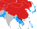
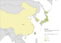
 East Asia.png 585 × 414; 12 KB
-
 East Asian Cultural Sphere - Updated.png 1,000 × 1,000; 280 KB
-
 East Asian Cultural Sphere wider influence.svg 541 × 541; 833 KB
-
 East Asian Cultural Sphere.png 1,000 × 1,000; 280 KB
-
 East Asian Cultural Sphere.svg 541 × 541; 832 KB
-
 East Asian Tigers.png 330 × 296; 11 KB
-
 East China Sea location map OSM eqc.svg 1,360 × 1,200; 162 KB
-
 East China Sea location map OSM.svg 1,360 × 1,200; 153 KB
-
 East Sea ko.png 600 × 600; 579 KB
-
 East-Asia HSR density1b.svg 1,150 × 800; 320 KB
-
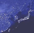 Eastasia lights edited.jpg 1,556 × 1,498; 220 KB
-
 EastAsia perCapitaGDPmap.png 9,473 × 9,532; 11.19 MB
-
 EASTERN ASIA Total Precipitation(mm) July 23 - 29, 2023.png 2,000 × 1,700; 704 KB
-
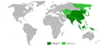
 Eastern Asia.png 718 × 624; 31 KB
-
 Eastern World.PNG 1,903 × 837; 188 KB
-
 Eastern World.svg 2,560 × 1,314; 1.12 MB
-
 EasternWorld.png 9,473 × 9,532; 9.27 MB
-
 Far East Council American Scouting overseas map divided.svg 370 × 218; 79 KB
-
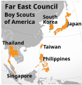 Far East Council American Scouting overseas map.svg 246 × 253; 631 KB
-
 Far east.png 1,427 × 628; 48 KB
-
 Far east3.png 1,427 × 628; 54 KB
-
 Fareast islands satellite picture by NASA's Blue Marble project.jpg 1,277 × 311; 200 KB
-
 Fareast islands satellite picture of The Blue Marble.jpg 1,277 × 311; 278 KB
-
 First island chain perimeter (marked in red).jpg 509 × 584; 69 KB
-
 Flower contest myth.png 873 × 643; 120 KB
-
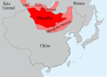 Greater Mongolia-pt.svg 800 × 571; 79 KB
-
 Greater Mongolia.svg 800 × 571; 76 KB
-
 H1N1 East Asia map.svg 503 × 359; 86 KB
-
 Hinduism Expansion in Asia 2023.svg 512 × 382; 780 KB
-
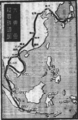
 Kankai ibun, (1807), vol. 8 (RBM-910-41-O88k-v8~026).jpg 3,634 × 5,031; 1.62 MB
-
 Kankai ibun, (1807), vol. 8 (RBM-910-41-O88k-v8~027).jpg 3,644 × 5,060; 1.6 MB
-
 Koppen-Geiger Map Eastern Asia future.svg 1,816 × 850; 4.53 MB
-
 Koppen-Geiger Map Eastern Asia present.svg 1,816 × 850; 4.58 MB
-
 Liancourt1894.png 1,515 × 868; 2.12 MB
-
 Line Music countries.png 1,104 × 1,268; 41 KB
-
 LocationEastAsia (WikiProject East Asia Version).png 1,357 × 628; 30 KB
-
 LocationEastAsia.PNG 1,357 × 628; 46 KB
-
 Map CH-A 01.jpg 179 × 179; 12 KB
-
 Map of East Asia (border).png 556 × 537; 78 KB
-
 Map of East Asia (physical, political, population) with legend (cropped).png 3,928 × 4,065; 60.93 MB
-
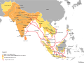
 Map of Greater East Asia Railroad.png 1,513 × 2,337; 1.34 MB
-
 Map of major fishing grounds near Taiwan.jpg 1,486 × 1,397; 348 KB
-
 Map of The east barbarian 0.png 1,077 × 936; 469 KB
-
 Membres francophonie - Asie de l'Est.png 743 × 435; 60 KB
-
 Modern and contemporary European history (1815-1921) (1922) (14804269153).jpg 2,800 × 1,719; 582 KB
-
 Natto-kinema-thua nao en 01.svg 358 × 393; 83 KB
-
 Natto-kinema-thua nao ru.svg 336 × 369; 99 KB
-
 Nida 2016-08-01 0430Z.png 1,302 × 1,134; 2.6 MB
-
 North East Asia location map.svg 81 × 71; 46 KB
-
 North Korea map-it.png 324 × 349; 17 KB
-
 North Korea map.gif 329 × 355; 21 KB
-
 Northeast Asia at 900 Khitan Bohai border-fr.svg 910 × 508; 100 KB
-
 Northeast Asia at 900 Khitan Bohai border.png 492 × 305; 345 KB
-
 Northeast Asia at 900-fr.svg 2,323 × 1,723; 1.98 MB
-
 Northeast Asia at 900.png 1,275 × 875; 2.41 MB
-

-

-
 P1994-2011.gif 590 × 525; 810 KB
-
 PAT - East Asia.gif 2,000 × 1,500; 998 KB
-
 Pieni 2 0791 China.png 514 × 437; 611 KB
-
 PR China map in 1958.jpg 2,498 × 3,093; 1.32 MB
-
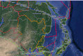
 Relief map of southern East Asia and northern Southeast Asia.png 1,360 × 1,300; 1.79 MB
-
 Shrimp among Whales.jpg 647 × 565; 194 KB
-
 Spheres of influence zh.png 280 × 253; 11 KB
-
 Taipan map.svg 512 × 683; 51 KB
-
 The literary digest (1890) (14804854983).jpg 1,968 × 3,566; 1.45 MB
-
 The Third World – Cockpit of Conflict, East Asia and the Pacific.png 780 × 626; 95 KB
-
 VOA China Korea Russia tripoint.png 720 × 486; 317 KB
-
 W. B. Duncan Map of the China Seas 1898 Cornell CUL PJM 1131 01.jpg 4,790 × 7,245; 6.09 MB
-
 Weathermap eastasia 0.png 1,200 × 800; 43 KB
-
 Карта Східної Азії (Карта Японії).png 1,238 × 1,304; 1.77 MB
-
 Проекция Альберса (GMT).gif 1,000 × 600; 43 KB
-
 Равноугольная коническая проекция Ламберта.gif 882 × 504; 35 KB
-
 日本列島.PNG 1,600 × 1,150; 3.28 MB
-
 東亜の気候区分に見る稲作の伝来経路諸説.png 923 × 728; 312 KB
-
 横メルカトル.png 920 × 689; 291 KB
-
 동아시아.png 627 × 625; 781 KB
%27_(11247606545).jpg)


.jpg)
_ca.png)


_(cropped).jpg)
.jpg)


_-_60E134E,_14N52N-color_topography,_borders,_labels.png)
_-_60E134E,_14N52N-color_topography.png)
_-_60E134E,_14N52N-grey_topography.png)
.jpg)


.PNG)
.svg)


_July_23_-_29,_2023.png)


.jpg)


,_vol._8_(RBM-910-41-O88k-v8~026).jpg)
,_vol._8_(RBM-910-41-O88k-v8~027).jpg)


.png)


.png)
_with_legend_(cropped).png)


_(1922)_(14804269153).jpg)


_(14804854983).jpg)


.png)
.gif)


.jpg)
.jpg)