Category:Maps of Dinosaur National Monument
Jump to navigation
Jump to search
US national monuments: Agate Fossil Beds · Aztec Ruins · Bandelier · Cabrillo · Canyon de Chelly · Cedar Breaks · Colorado · Craters of the Moon · Devils Postpile · Devils Tower · Dinosaur · Effigy Mounds · Florissant Fossil Beds · Gila Cliff Dwellings · Hovenweep · Jewel Cave · John Day Fossil Beds · Lava Beds · Little Bighorn Battlefield · Montezuma Castle · Muir Woods · Natural Bridges · Organ Pipe Cactus · Rainbow Bridge · Statue of Liberty · Sunset Crater Volcano · Timpanogos Cave · Walnut Canyon · Wupatki ·
English: Maps of Dinosaur National Monument
Wikimedia category | |||||
| Upload media | |||||
| Instance of | |||||
|---|---|---|---|---|---|
| Category combines topics | |||||
| Dinosaur National Monument | |||||
national monument in Uintah County, Utah and Moffat County, Colorado in the United States   | |||||
| Instance of | |||||
| Location |
| ||||
| Visitor center | |||||
| Operator | |||||
| Heritage designation |
| ||||
| IUCN protected areas category | |||||
| Inception |
| ||||
| official website | |||||
 | |||||
Media in category "Maps of Dinosaur National Monument"
The following 24 files are in this category, out of 24 total.
-
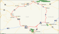 DinosaurDiamond map.svg 1,475 × 860; 769 KB
-
 DNM Quarry map.jpg 21,241 × 6,151; 12.39 MB
-
 Echo Park Dam proposal.png 1,405 × 1,273; 2.48 MB
-
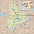 Greenutrivermap.png 500 × 500; 409 KB
-
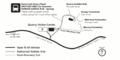
 NPS dinosaur-campground-map.jpg 688 × 478; 109 KB
-
 NPS dinosaur-context-map.jpg 688 × 345; 125 KB
-
 NPS dinosaur-echo-park-map.jpg 688 × 787; 81 KB
-
 NPS dinosaur-fossil-discovery-trail-map.gif 932 × 468; 40 KB
-
 NPS dinosaur-gates-of-lodore-campground-map.jpg 688 × 1,570; 124 KB
-
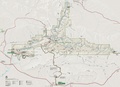
 NPS dinosaur-geologic-map.jpg 6,373 × 4,188; 6.03 MB
-
 NPS dinosaur-green-river-campground-map.jpg 688 × 877; 117 KB
-
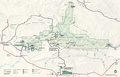
 NPS dinosaur-map.jpg 3,689 × 2,659; 1.41 MB
-
 NPS dinosaur-map.pdf 3,458 × 2,491; 14.55 MB
-
 NPS dinosaur-national-monument-map.jpg 2,512 × 1,616; 632 KB
-
 NPS dinosaur-national-monument-map.pdf 2,512 × 1,616; 1.34 MB
-
 NPS dinosaur-national-monument-vegetation-map.jpg 3,667 × 2,645; 1.46 MB
-
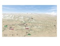
 NPS dinosaur-oblique-map.jpg 3,012 × 1,765; 690 KB
-
 NPS dinosaur-oblique-map.pdf 2,508 × 1,470; 808 KB
-
 NPS dinosaur-rainbow-park-campground-map.jpg 688 × 944; 88 KB
-
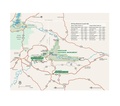
 NPS dinosaur-regional-map.jpg 1,312 × 1,026; 200 KB
-
 NPS dinosaur-regional-map.pdf 1,229 × 960; 397 KB
-
 NPS dinosaur-river-campsite-map.jpg 688 × 392; 63 KB
-
 NPS dinosaur-river-map.gif 2,034 × 1,476; 160 KB
-
 NPS dinosaur-split-mountain-campground-picnic-area-map.jpg 688 × 1,267; 52 KB


