<nowiki>Category:Maps of Dalfsen; categoría de Wikimedia; kategori Wikimedia; Wikimedia category; د ويکيمېډيا وېشنيزه; Vikimedya kategorisi; ویکیمیڈیا زمرہ; kategória projektov Wikimedia; категорія проєкту Вікімедіа; 维基媒体分类; Wikimedia-Kategorie; Викимедиина категорија; kategorija na Wikimediji; विकिपीडिया:श्रेणी; page de catégorie de Wikimedia; kategorija na Wikimediji; विकिपीडिया वर्ग; категорија на Викимедији; Wikimedia-Kategorie; Wikimedia-kategori; kategori Wikimédia; تصنيف ويكيميديا; pajenn rummata eus Wikimedia; Wikimedia:ကဏ္ဍခွဲခြင်း; 維基媒體分類; Wikimedia категориясы; categoría de Wikimedia; categoria de Wikimedia; Викимедиа категорияһы; tudalen categori Wikimedia; Viciméid catagóir; ردهٔ ویکیپدیا; 维基媒体分类; Wikimedia-kategory; ვიკიპედია:კატეგორიზაცია; ウィキメディアのカテゴリ; categoria Wikimedia; تصنيف بتاع ويكيميديا; විකිමීඩියා ප්රභේද පිටුව; categoria Vicimediorum; विकिमीडिया वर्गः; विकिमीडिया श्रेणी; Wikimedia-luokka; Wikimedia category; guruhi Vikimedia; катэгорыя ў праекце Вікімэдыя; Викимедиа проектындагы төркем; catigurìa di nu pruggettu Wikimedia; หน้าหมวดหมู่วิกิมีเดีย; Wikimedia:Kategorija; Wikimedia-Kategorie; Wikimedia:Klassys; категория на Уикимедия; categorie a unui proiect Wikimedia; 維基媒體分類; Wikimedia-kategori; kawan Wikimèdia; 維基媒體分類; 위키미디어 분류; Wikimedia-bólkur; kategorio en Vikimedio; kategori Wikimedia; categoría de Wikimedia; উইকিমিডিয়া বিষয়শ্রেণী; kategori Wikimedia; 维基媒体分类; וויקימעדיע קאַטעגאָריע; kategorija w projektach Wikimedije; thể loại Wikimedia; Wikimedia projekta kategorija; kategoria ti Wikimedia; categoria de um projeto da Wikimedia; 维基媒体分类; категорияд Ангилал; Wikimedia-kategori; kategori Wikimedia; پۆلی ویکیمیدیا; Wikimedia category; Vikimédia ñemohenda; Wikimédia-kategória; વિકિપીડિયા શ્રેણી; Wikimediako kategoria; категория в проекте Викимедиа; Wikimedia-Kategorie; катэгорыя ў праекце Вікімедыя; Wikimedia-kategorie; Wîkîmediya:Kategorî; विकिमिडिया श्रेणी; Wikimedia-Kategorie; קטגוריה במיזמי ויקימדיה; Викимедиа проектындагы төркем; κατηγορία εγχειρημάτων Wikimedia; விக்கிமீடியப் பகுப்பு; विकिमिडिया श्रेणी; Wikimedia-kategoriija; гурӯҳи Викимедиа; kategoria w projekcie Wikimedia; 維基媒體分類; Wikimedia:Ronnaghys; categoria di un progetto Wikimedia; Wikimedia-Kategorie; Wikimedia category; Վիքիմեդիայի նախագծի կատեգորիա; 維基媒體分類; Wikimedia kategooria; categurìa 'e nu pruggette Wikimedia; Wikimedia-categorie; Wikimedia proyektındağı törkem; ẹ̀ka Wikimedia; гурӯҳи Викимедиа; categoria de um projeto da Wikimedia; kategorie na projektech Wikimedia; Wikimedia-Kategorie; tumbung Wikimedia; Wikimedia-categorie; kategorija Wikimedie; kategorya ng Wikimedia; Wikimedia-kategori; Wikimedia-kategorie; kategori Wikimedia; jamii ya Wikimedia; വിക്കിമീഡിയ വർഗ്ഗം; Wikimedia-categorie; kategori Wikimedia; Vikipidiya:Shopni; زمرو:وڪيپيڊيا زمرا بندي; Wikimedia-Kategorie; categoría de Wikimedia; kategori e Wikimedias; 维基媒体分类; Kategoriya ning Wikimedia</nowiki>
Subcategories
This category has only the following subcategory.


.svg)

 Map - NL - Municipality code 0148 (2009).svg 300 × 160; 530 KB
 2013-Dalfsen.jpg 2,800 × 3,442; 4.92 MB
 BAG woonplaatsen - Gemeente Dalfsen.png 2,419 × 2,419; 707 KB
 Dalfsen, Gemeenteatlas van Nederland.jpg 724 × 1,000; 160 KB
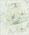 Gem-Dalfsen-2014Q1.jpg 5,570 × 6,755; 12.85 MB
 Gem-Dalfsen-OpenTopo.jpg 5,369 × 6,768; 3.98 MB
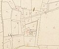 Havezate De Kuile, kadastrale kaart 1811-1832.jpg 2,393 × 1,976; 1,002 KB
 Janssonius1658.gif 671 × 502; 356 KB
 Kadastrale kaart 1811-1832, minuutplan Dalfsen, Overijssel, sectie H, blad 03 (Hoonhorst).jpg 12,246 × 7,916; 18.8 MB
 Kadastrale kaart 1811-1832, minuutplan Dalfsen, Overijssel, sectie I, blad 02.jpg 12,224 × 7,848; 14.18 MB
 Kadastrale kaart 1811-1832, minuutplan Dalfsen, Overijssel, sectie K, blad 05.jpg 12,042 × 7,870; 18.39 MB
 LocatieDalfsen.png 280 × 130; 8 KB
 Map - NL - Dalfsen (2009).svg 625 × 575; 1.95 MB
 NW-Oaveriessel1773.gif 650 × 484; 287 KB
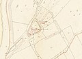


.jpg)


.svg)

