Category:Maps of Culver City, California
Jump to navigation
Jump to search
Media in category "Maps of Culver City, California"
The following 8 files are in this category, out of 8 total.
-

-
 California - Culver City - NARA - 23934227 (cropped).jpg 3,104 × 3,524; 6.39 MB
-
 California - Culver City - NARA - 23934227.jpg 3,360 × 4,352; 8.34 MB
-
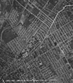
 Culver City circa 1943.jpg 1,740 × 1,901; 1.5 MB
-
 Culver City in LA County map.png 800 × 530; 109 KB
-
 Downtown Culver City 1924 USGS topographical.jpg 697 × 1,509; 549 KB
-
 LA County Incorporated Areas Culver City highlighted.svg 950 × 780; 262 KB
-

_-_Los_Angeles_County_-_Culver_City_-_ED_19-407_to_429_-_NARA_-_7634542.jpg)
.jpg)


),_sheet_13_(1382).jpg)