Category:Maps of Crimean Khanate
Jump to navigation
Jump to search
Wikimedia category | |||||
| Upload media | |||||
| Instance of | |||||
|---|---|---|---|---|---|
| Category combines topics | |||||
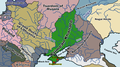
| Crimean Khanate | |||||
former state at the Crimean Peninsula until April 1783 .svg)  .jpg) | |||||
| Instance of | |||||
| Capital |
| ||||
| Basic form of government |
| ||||
| Official language |
| ||||
| Inception |
| ||||
| Dissolved, abolished or demolished date |
| ||||
| Population |
| ||||
| Area |
| ||||
| Religion or worldview | |||||
 | |||||
Subcategories
This category has only the following subcategory.
M
Media in category "Maps of Crimean Khanate"
The following 24 files are in this category, out of 24 total.
-
 "Taurica Chersonesus, Nostra aetate Przecopsca, et Gazara dicitur. " (22065026578).jpg 3,966 × 3,048; 1.84 MB
-

-

-
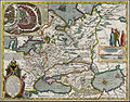
 1644 Europa Recens Blaeu Crimea.jpg 1,667 × 1,083; 876 KB
-
 1730 map of the Black Sea by Matthaus Seutter.jpg 6,982 × 6,034; 8.7 MB
-
 Crimea 1502 Ortho.svg 8,054 × 6,897; 763 KB
-
 Crimean Khanate 1550.png 1,425 × 798; 247 KB
-
 Crimean Khanate Map 1502.svg 414 × 285; 206 KB
-

-
 Europe and northern Africa. HM 29. PORTOLAN ATLAS, anonymous (Dieppe, 1547).S.jpg 1,913 × 1,247; 927 KB
-
 FER, Nicolas de, La Mer Noire, ca. 1705.jpg 1,520 × 1,100; 1.67 MB
-
 Khanat de crimée en 1502.svg 414 × 285; 207 KB
-
 Khanat de Crimée.png 985 × 669; 85 KB
-
 Krimkhanat um 1550.jpg 760 × 425; 340 KB
-
 Moll, Herman. Turkey in Asia; or Asia Minor &c. 1736 (F).jpg 1,628 × 751; 281 KB
-

-

-

-
 Russian campaigns in the Crimean Tatarian Khanate 1736.jpg 1,793 × 1,537; 2.79 MB
-

-
 The Crimean Khanate at its maximum extent (1525).png 2,151 × 1,324; 82 KB
-
-
 Карта Чёрного моря, 1697 год.jpg 1,599 × 1,249; 639 KB
-
 Мала татарія, Україна - держава козаків.jpg 4,000 × 3,443; 2.39 MB
.jpg)
_and_Ukraine_-_Geographicus_-_Moschovia-porcacchi-1572.jpg)


.S.jpg)


.jpg)

.jpg)


.jpg)
.png)


