Category:Maps of Cascadia
Jump to navigation
Jump to search
Subcategories
This category has only the following subcategory.
S
- Maps of Cascadia Subduction Zone (18 F)
Media in category "Maps of Cascadia"
The following 14 files are in this category, out of 14 total.
-
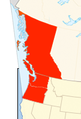
 Administrative divisions of the Republic of Cascadia.png 2,348 × 4,628; 184 KB
-
 Cascadia bioregion map.png 174 × 221; 7 KB
-
 Cascadia Bioregion.png 3,000 × 2,060; 8.26 MB
-
 Cascadia flag map.png 768 × 768; 35 KB
-
 Cascadia map and bioregion vector.svg 1,588 × 2,500; 381 KB
-
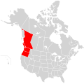 Cascadia map.svg 1,730 × 1,730; 216 KB
-
 Cascadia map2.svg 1,730 × 1,730; 140 KB
-
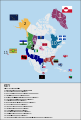
 Cascadia-flags.png 856 × 1,232; 52 KB
-
 CascadiaMap.png 720 × 1,370; 1.08 MB
-
 Cascdia.png 135 × 199; 29 KB
-
 Map of list of active separatist movements in north america.svg 1,168 × 1,065; 6.37 MB
-
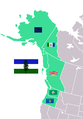
 Map Regions Cascadia.png 404 × 600; 26 KB
-
 N. America separatism.svg 2,642 × 3,902; 1.18 MB
-
 Oregoncountry2.png 992 × 1,011; 1.04 MB


