Category:Maps of Caroline County, Maryland
Jump to navigation
Jump to search
Counties of Maryland: Allegany · Anne Arundel · Baltimore · Calvert · Caroline · Carroll · Cecil · Charles · Dorchester · Frederick · Garrett · Harford · Howard · Kent · Montgomery · Prince George's · Queen Anne's · Somerset · St. Mary's · Talbot · Washington · Wicomico · Worcester · Independent city:
Wikimedia category | |||||
| Upload media | |||||
| Instance of | |||||
|---|---|---|---|---|---|
| Category combines topics | |||||
| Caroline County | |||||
county in Maryland, United States     | |||||
| Instance of | |||||
| Part of | |||||
| Named after |
| ||||
| Location | Maryland | ||||
| Located in or next to body of water |
| ||||
| School district | |||||
| Capital | |||||
| Inception |
| ||||
| Population |
| ||||
| Area |
| ||||
| Different from | |||||
| official website | |||||
 | |||||
Subcategories
This category has only the following subcategory.
Media in category "Maps of Caroline County, Maryland"
The following 23 files are in this category, out of 23 total.
-

-

-

-

-

-

-

-

-

-

-
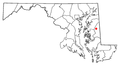
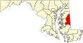 Map of Maryland highlighting Caroline County.svg 3,858 × 2,019; 139 KB
-
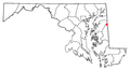
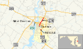 Maryland Route 619 map.svg 1,004 × 591; 444 KB
-
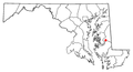
 MDMap-doton-Denton.PNG 300 × 162; 10 KB
-
 MDMap-doton-Federalsburg.PNG 300 × 162; 10 KB
-
 MDMap-doton-Goldsboro.PNG 300 × 162; 10 KB
-
 MDMap-doton-Greensboro.PNG 300 × 162; 10 KB
-
 MDMap-doton-Harmony.PNG 300 × 162; 10 KB
-
 MDMap-doton-Henderson.PNG 300 × 162; 10 KB
-
 MDMap-doton-Hillsboro.PNG 300 × 162; 10 KB
-
 MDMap-doton-Marydel.PNG 300 × 162; 10 KB
-
 MDMap-doton-Preston.PNG 300 × 162; 10 KB
-
 MDMap-doton-Ridgely.PNG 300 × 162; 10 KB
-
 MDMap-doton-Templeville.PNG 300 × 162; 10 KB


