Category:Maps of Cache County, Utah (style A)
Jump to navigation
Jump to search
Media in category "Maps of Cache County, Utah (style A)"
The following 24 files are in this category, out of 24 total.
-
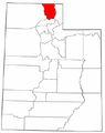 Map of Utah highlighting Cache County.png 238 × 300; 16 KB
-
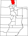 Map of Utah highlighting Cache County.svg 4,457 × 5,566; 56 KB
-
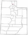
 UTMap-doton-Amalga.png 238 × 300; 18 KB
-
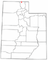
 UTMap-doton-Avon.PNG 238 × 300; 18 KB
-
 UTMap-doton-Benson.PNG 238 × 300; 18 KB
-
 UTMap-doton-Cache.PNG 238 × 300; 18 KB
-
 UTMap-doton-Clarkston.PNG 238 × 300; 18 KB
-
 UTMap-doton-Cornish.PNG 238 × 300; 18 KB
-
 UTMap-doton-Cove.PNG 238 × 300; 18 KB
-
 UTMap-doton-HydePark.PNG 238 × 300; 18 KB
-
 UTMap-doton-Hyrum.PNG 238 × 300; 18 KB
-
 UTMap-doton-Lewiston.PNG 238 × 300; 18 KB
-
 UTMap-doton-Logan.PNG 238 × 300; 18 KB
-
 UTMap-doton-Mendon.png 238 × 300; 18 KB
-
 UTMap-doton-Millville.png 238 × 300; 18 KB
-
 UTMap-doton-Newton.PNG 238 × 300; 18 KB
-
 UTMap-doton-Nibley.PNG 238 × 300; 18 KB
-
 UTMap-doton-NorthLogan.PNG 238 × 300; 18 KB
-
 UTMap-doton-Paradise.png 238 × 300; 18 KB
-
 UTMap-doton-Providence.PNG 238 × 300; 18 KB
-
 UTMap-doton-Richmond.PNG 238 × 300; 19 KB
-
 UTMap-doton-RiverHeights.PNG 238 × 300; 18 KB
-
 UTMap-doton-Trenton.PNG 238 × 300; 19 KB
-
 UTMap-doton-Wellsville.PNG 238 × 300; 18 KB


