Category:Maps of Brockton, Massachusetts
Jump to navigation
Jump to search
Subcategories
This category has only the following subcategory.
Media in category "Maps of Brockton, Massachusetts"
The following 12 files are in this category, out of 12 total.
-
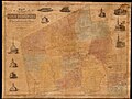 1853 map of North Bridgewater, Massachusetts.jpg 8,824 × 6,584; 7.32 MB
-
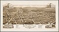
 1878 bird's eye view map of Brockton, Massachusetts.jpg 8,601 × 6,903; 11.14 MB
-
 1880 bird's eye view map of Campello, Brockton, Massachusetts.jpg 8,704 × 4,728; 5.72 MB
-
 Bird's eye view map of Brockton, Massachusetts, circa 1882.jpg 9,760 × 6,544; 8.66 MB
-
 1891 map of Brockton, Massachusetts.png 3,500 × 2,444; 9.22 MB
-
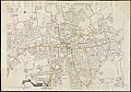 1909 map of Brockton, Massachusetts.jpg 6,944 × 4,860; 4.21 MB
-
 Bird's eye view of the city of Brockton, Plymouth County, Mass. 1882. LOC 76693075.jpg 12,208 × 7,728; 19.59 MB
-
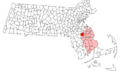 Brockton ma highlight.png 788 × 466; 54 KB
-
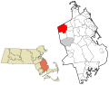
 Brockton MA lg.png 2,400 × 1,492; 164 KB
-
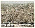
 Brockton, Mass. - 1878. LOC 2009579070.jpg 11,253 × 8,821; 21.07 MB
-
-
 Race and ethnicity 2020 Brockton, MA.png 2,400 × 2,404; 2.15 MB


