Category:Maps of Breisgau
Jump to navigation
Jump to search
Subcategories
This category has only the following subcategory.
M
Media in category "Maps of Breisgau"
The following 15 files are in this category, out of 15 total.
-
 "Alsatia Landgraviatus cum Suntgoia et Birsgoia - Ger. Mercatore auctore" (22070535369).jpg 6,903 × 2,576; 4.02 MB
-

-

-

-
 Le flambeau de la guerre allumee au Rhin 1735 (81480775).jpg 5,979 × 4,531; 4.28 MB
-
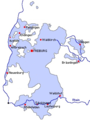 Breisgau 1803.png 284 × 379; 101 KB
-
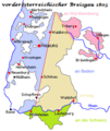 Breisgau 1805.png 285 × 339; 15 KB
-

-
 Herrschaft Badenweiler untere Vogteien 1718.jpg 650 × 574; 409 KB
-
 LASB K Hellwig 0755.jpg 3,174 × 2,268; 1.69 MB
-
 Map of Breisgau 1600.jpg 800 × 600; 163 KB
-
 Map-Buchsweiler-March01.png 1,860 × 1,614; 482 KB
-
 Schwäbischer Kreis 1805.jpg 1,890 × 1,638; 812 KB
-

-
 The Breisgau, circa 1720.jpg 1,102 × 1,276; 1.01 MB
%27_(11171099514).jpg)
%27_(11168398576).jpg)
_-_Geographicus_-_AlsatiaSuperior-jansson-1644.jpg)
.jpg)


.jpg)