Category:Maps of Bangalore
Jump to navigation
Jump to search
Wikimedia category | |||||
| Upload media | |||||
| Instance of | |||||
|---|---|---|---|---|---|
| Category combines topics | |||||
| Bengaluru | |||||
city in Karnataka, India    _6-23-2010_8-51-06_AM.jpg)   | |||||
| Instance of |
| ||||
| Location | |||||
| Official language | |||||
| Founded by | |||||
| Inception |
| ||||
| Significant event |
| ||||
| Population |
| ||||
| Area |
| ||||
| Elevation above sea level |
| ||||
| Different from | |||||
| official website | |||||
 | |||||
Subcategories
This category has the following 6 subcategories, out of 6 total.
A
- Animated maps of Bangalore (7 F)
L
- Locator maps of Bangalore (8 F)
O
- Old maps of Bangalore (24 F)
- OpenStreetMap maps of Bangalore (11 F)
P
S
- SVG maps of Bangalore (13 F)
Media in category "Maps of Bangalore"
The following 16 files are in this category, out of 16 total.
-
 Bangalore 77.58328E 12.98331N.jpg 1,280 × 958; 278 KB
-
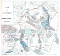 Bangalore Cantonment Map.png 1,479 × 1,386; 3.13 MB
-
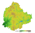 Bangalore elevation map with waterbodies.png 2,015 × 1,858; 1.36 MB
-
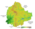 Bangalore elevation with NS ridge and valley labels.png 1,371 × 1,141; 929 KB
-
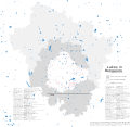
 Bangalore Locality Map.png 3,728 × 3,348; 4.87 MB
-
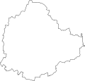 Bangalore Outline.svg 547 × 522; 35 KB
-
 Bangalore Schematic Map.png 1,730 × 917; 206 KB
-
 Bengaluru Urban Area Map.png 1,156 × 810; 2.22 MB
-
 BMRDA Map.png 301 × 368; 191 KB
-
 Building footprints of Shivajinagar, Bengaluru.png 1,212 × 850; 825 KB
-
 Directions to CIS Domlur Bangalore.png 644 × 594; 238 KB
-
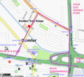 Directions to TERI Domlur Bangalore.png 644 × 594; 157 KB
-
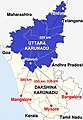 Distance from major cities to North Karnataka.jpg 533 × 771; 101 KB
-
 Jaraganahalli (Survey map of 1904).jpg 846 × 1,276; 182 KB
-
 Lakes in Bangalore, BBMP, Urban district, Rural district.svg 6,441 × 6,286; 3.11 MB
-
 Lakes in Bangalore.svg 934 × 730; 2.12 MB


.jpg)

