Category:Maps of Bad Driburg
Jump to navigation
Jump to search
Kreis Höxter  Bad Driburg · Beverungen · Borgentreich · Höxter · Marienmünster · Nieheim · Steinheim · Warburg · Willebadessen ·
Wikimedia category | |||||
| Upload media | |||||
| Instance of | |||||
|---|---|---|---|---|---|
| Category combines topics | |||||
| Bad Driburg | |||||
municipality of Germany     | |||||
| Instance of |
| ||||
| Location | Höxter, Detmold Government Region, North Rhine-Westphalia, Germany | ||||
| Population |
| ||||
| Area |
| ||||
| Elevation above sea level |
| ||||
| official website | |||||
 | |||||
Deutsch: Karten von Bad Driburg, Deutschland.
Media in category "Maps of Bad Driburg"
The following 17 files are in this category, out of 17 total.
-
 Bad Driburg geothermische Karte.png 600 × 700; 62 KB
-
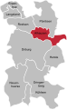
 Bad Driburg in HX.svg 530 × 530; 281 KB
-
 Bad Driburg Ortsteile Alhausen.svg 995 × 1,615; 138 KB
-
 Bad Driburg Ortsteile Bad Hermannsborn.svg 995 × 1,615; 158 KB
-
 Bad Driburg Ortsteile Dringenberg.svg 995 × 1,615; 138 KB
-
 Bad Driburg Ortsteile Erpentrup.svg 995 × 1,615; 138 KB
-
 Bad Driburg Ortsteile Herste.svg 995 × 1,615; 138 KB
-
 Bad Driburg Ortsteile Kühlsen.svg 995 × 1,615; 138 KB
-
 Bad Driburg Ortsteile Langeland.svg 995 × 1,615; 138 KB
-
 Bad Driburg Ortsteile Neuenheerse.svg 995 × 1,615; 138 KB
-
 Bad Driburg Ortsteile Pömbsen.svg 995 × 1,615; 138 KB
-
 Bad Driburg Ortsteile Reelsen.svg 995 × 1,615; 138 KB
-
 Bad Driburg Ortsteile.svg 995 × 1,615; 138 KB
-
 Karte NSG Kiebitzteich Bad Driburg Reelsen.png 1,155 × 863; 88 KB
-
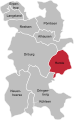
 Lage-Bad-Driburg-in-HX.png 1,600 × 2,182; 849 KB
-
 Satzer Moor Flächennutzung.jpg 1,529 × 1,478; 1.11 MB
-
 Satzer Moor Uraufnahme.jpg 1,501 × 1,364; 1.61 MB


